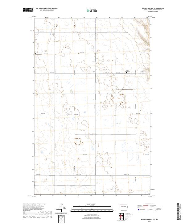
2024 Map of Mouse River Park SW
USGS Topo · Published 2024About this map
Zion Lutheran Cem and Evanger Lutheran Cem serve as quiet anchors for the rural landscape of Renville County. This northern North Dakota terrain is defined by a rigorous section-line grid, where gravel and dirt roads like 100th St NW and 54th Ave NW intersect across a landscape pocked with countless small wetlands and prairie potholes. The map reveals the persistence of early 20th-century settlement patterns, where church-affiliated burial grounds and family-named markers like Brekhus Field remain the primary landmarks between isolated farmsteads. The drainage and topography show the subtle undulations typical of the Missouri Plateau, with most development concentrated along these established county roads. The systematic layout of the Public Land Survey System, including t162n r87w and t162n r86w, provides the framework for this high-plains agricultural community.
Find a feature on this map
21 named features on this map. Tap any name to fly to it.
Don’t see what you’re looking for? This feature index may not catch every label — zoom into the map to look around manually.
Map Details
Editions of this 2024 Mouse River Park SW Map
This is the sole edition of this map. No revisions or reprints were ever made.
Other maps of this area

1947 · Tolley
USGS Topo · 1:62,500

1948 · Kenmare
USGS Topo · 1:24,000

1948 · Norma
USGS Topo · 1:24,000

1948 · Mouse River Park NW
USGS Topo · 1:24,000

1948 · Tolley
USGS Topo · 1:24,000

1949 · Mouse River Park NW
USGS Topo · 1:24,000

1949 · Bowbells SE
USGS Topo · 1:24,000

1949 · Bowbells NE
USGS Topo · 1:24,000

1949 · Mouse River Park NE
USGS Topo · 1:24,000

1949 · Mouse River Park SW
USGS Topo · 1:24,000