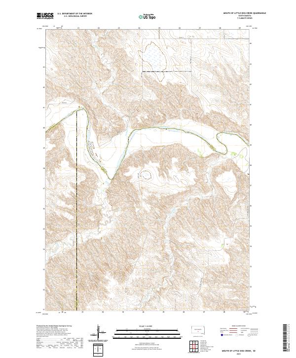
2021 Map of Mouth of Little Dog Creek
USGS Topo · Published 2021About this map
The White River carves a winding path through this South Dakota landscape, creating a dramatic corridor of deeply dissected breaks and ridges that contrast with the surrounding high plains. The confluence where Little Dog Cr enters the river valley defines the central topography, while the Pahapesto Buttes rise as prominent landmarks along the eastern edge. This 2021 survey reveals a territory structured by the intersection of Lyman, Mellette, and Tripp counties, where the land is primarily organized by a sparse network of section-line roads like 297th Ave and 300th Ave. Significant drainage systems including Sedlano Cr and Oak Cr feed into the river basin, illustrating the complex erosion patterns typical of this Missouri Plateau region. The map preserves the modern rural character of the area, showing the enduring ranching and agricultural framework of south-central South Dakota.
Find a feature on this map
19 named features on this map. Tap any name to fly to it.
Don’t see what you’re looking for? This feature index may not catch every label — zoom into the map to look around manually.
Map Details
Editions of this 2021 Mouth of Little Dog Creek Map
This is the sole edition of this map. No revisions or reprints were ever made.
Other maps of this area

1951 · Badnation
USGS Topo · 1:24,000

1951 · Presho 4 NE
USGS Topo · 1:24,000

1951 · Presho 4 NW
USGS Topo · 1:24,000

1955 · Martin
USGS Topo · 1:250,000

1958 · Martin
USGS Topo · 1:250,000

1972 · Vivian SE
USGS Topo · 1:24,000
1978 · Presho SE
USGS Topo · 1:24,000

1978 · Presho SW
USGS Topo · 1:24,000

1982 · Presho 4 SE
USGS Topo · 1:25,000

1982 · Two Nation Creek
USGS Topo · 1:25,000