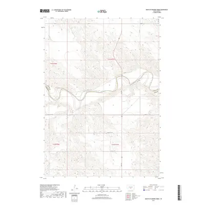
2017 Map of Mouth of Mission Creek
USGS Topo · Published 2017About this map
White River meanders across the central portion of this South Dakota landscape, forming a natural boundary in a region defined by its significant drainage networks. The terrain is marked by the Pahapesto Buttes, which rise above the surrounding plains. Tributaries including Mission Cr, Cottonwood Cr, and Bull-Iron Cr carve through the prairie, illustrating the complex hydrology of the Lyman and Tripp County border.
Find a feature on this map
15 named features on this map. Tap any name to fly to it.
Don’t see what you’re looking for? This feature index may not catch every label — zoom into the map to look around manually.
Map Details
Editions of this 2017 Mouth of Mission Creek Map
This is the sole edition of this map. No revisions or reprints were ever made.
Other maps of this area

1951 · Presho 4 NE
USGS Topo · 1:24,000

1951 · Ideal NW
USGS Topo · 1:24,000

1951 · Presho 4 NW
USGS Topo · 1:24,000

1955 · Martin
USGS Topo · 1:250,000

1955 · Mitchell
USGS Topo · 1:250,000

1958 · Martin
USGS Topo · 1:250,000

1959 · Mitchell
USGS Topo · 1:250,000

1978 · Kennebec SW
USGS Topo · 1:24,000
1978 · Presho SE
USGS Topo · 1:24,000

1978 · Presho SW
USGS Topo · 1:24,000