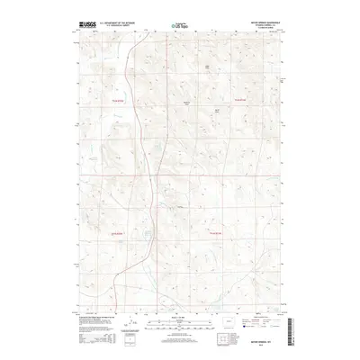
2015 Map of Moyer Springs
USGS Topo · Published 2015About this map
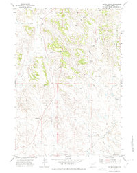
The Little Powder River creates a central corridor through this Campbell County landscape, joined by various ephemeral tributaries such as Corral Cr and the Dry Fork Little Powder River. This 2015 data reflects the ranching and industrial legacy of the region, where water management is critical to land use. Artificial water features like the Rawhide Mine Main Reservoir and Rawhide Reservoir sit alongside traditional water sources like Moyer Springs and Six Half Circle Spring. The presence of Wildwood and numerous named draws, including Windmill Draw and Cedar Draw, indicates a landscape shaped by both the natural drainage patterns and the practical needs of livestock and energy extraction. To the south, Garner Lake and Halsted Spring further highlight the scattered aquatic resources that define navigation and property in this semi-arid high plains environment.
Find a feature on this map
25 named features on this map. Tap any name to fly to it.
Don’t see what you’re looking for? This feature index may not catch every label — zoom into the map to look around manually.
Map Details
Editions of this 2015 Moyer Springs Map
This is the sole edition of this map. No revisions or reprints were ever made.
Other maps of this area

1954 · Gillette
USGS Topo · 1:250,000

1955 · Gillette
USGS Topo · 1:250,000

1958 · Gillette
USGS Topo · 1:250,000

1962 · Gillette
USGS Topo · 1:250,000

1971 · Gillette East
USGS Topo · 1:24,000

1971 · Green Hill
USGS Topo · 1:24,000
1971 · Calf Creek
USGS Topo · 1:24,000
1971 · Gillette West
USGS Topo · 1:24,000
1971 · Rawhide School
USGS Topo · 1:24,000
1971 · Moyer Springs
USGS Topo · 1:24,000