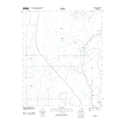
2010 Map of Moyers
USGS Topo · Published 2010About this map
Miller and Moyers serve as the primary settlement points in this pocket of Pushmataha County, where the landscape is defined by the winding course of the Kiamichi River and a series of prominent peaks including White Rock Mountain and Razorback Mountain. The modern transit corridor of the Indian Nation Tpke cuts diagonally through the center of the quadrangle, contrasting with older routes like Old Moyers Rd. For those researching family history, both the Miller Cemetery and Moyers Cemetery are clearly marked near their respective communities.
Find a feature on this map
52 named features on this map. Tap any name to fly to it.
Don’t see what you’re looking for? This feature index may not catch every label — zoom into the map to look around manually.
Map Details
Editions of this 2010 Moyers Map
This is the sole edition of this map. No revisions or reprints were ever made.
Other maps of this area

1901 · Antlers
USGS Topo · 1:125,000

1912 · Antlers
USGS Topo · 1:125,000

1925 · Antlers
USGS Topo · 1:125,000

1950 · Mcalester
USGS Topo · 1:250,000

1957 · Farris
USGS Topo · 1:24,000

1957 · Moyers
USGS Topo · 1:24,000

1957 · Jumbo
USGS Topo · 1:24,000

1957 · Lane NE
USGS Topo · 1:24,000
1961 · Darwin
USGS Topo · 1:24,000

1961 · Antlers East
USGS Topo · 1:24,000