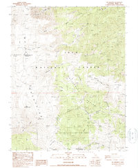
1987 Map of Mt. Barcroft
USGS Topo · Published 1987About this map
Scientific research and high-altitude alpine ecology define this 1980s landscape within the Inyo National Forest. Perched high in the White Mountains, the White Mtn Research Station Barcroft Laboratory and its accompanying Observatory sit near the summit of Mt Barcroft, representing a critical site for high-elevation atmospheric and biological study. To the south, the Ancient Bristlecone Pine Forest protects some of the oldest living organisms on Earth, centered around features like the Patriarch Tree Picnic Area. The terrain is marked by a network of ephemeral water sources and named meadows, including McAfee Meadow and Tres Plumas Meadow. Evidence of historical exploration and land use appears in the form of the Eva Belle Mine, Stone Corral, and various 4WD tracks that navigate the basins between peaks like Piute Mountain and Sheep Mountain.
Find a feature on this map
39 named features on this map. Tap any name to fly to it.
Don’t see what you’re looking for? This feature index may not catch every label — zoom into the map to look around manually.
Map Details
Editions of this 1987 Mt. Barcroft Map
This is the sole edition of this map. No revisions or reprints were ever made.
Other maps of this area

1913 · Bishop
USGS Topo · 1:125,000

1917 · White Mountain
USGS Topo · 1:125,000

1947 · Mariposa
USGS Topo · 1:250,000

1948 · Mariposa
USGS Topo · 1:250,000

1949 · Bishop
USGS Topo · 1:62,500

1951 · Bishop
USGS Topo · 1:62,500

1951 · Blanco Mountain
USGS Topo · 1:62,500

1957 · Mariposa
USGS Topo · 1:250,000

1962 · Mt. Barcroft
USGS Topo · 1:62,500

1962 · White Mtn. Peak
USGS Topo · 1:62,500