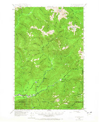
1947 Map of Mt Christie
USGS Topo · Published 1965About this map
Olympic National Park and the adjacent Olympic National Forest define this 1947 survey, capturing a primitive landscape of the Olympic Peninsula before modern development. The map traces the upper reaches of the Quinault River and its various forks, highlighting a network of remote infrastructure essential for early forest management and backcountry travel. Notable landmarks include the North Fork Ranger Station and several trailside refuges such as Sixmile Shelter and Wolf Bar Shelter.
Find a feature on this map
68 named features on this map. Tap any name to fly to it.
Don’t see what you’re looking for? This feature index may not catch every label — zoom into the map to look around manually.
Map Details
Editions of this 1947 Mt Christie Map
3 editions found
Other maps of this area

1921 · Quinault Lake
USGS Topo · 1:62,500

1921 · Satsop
USGS Topo · 1:62,500

1935 · Mount Olympus
USGS Topo · 1:62,500

1938 · Mt Constance
USGS Topo · 1:125,000

1939 · Mount Tom
USGS Topo · 1:62,500

1942 · Mount Olympus
USGS Topo · 1:62,500

1944 · Mt. Angeles
USGS Topo · 1:62,500

1946 · Mt. Angeles
USGS Topo · 1:62,500

1947 · Mt. Steel
USGS Topo · 1:62,500

1947 · Mt Christie
USGS Topo · 1:62,500