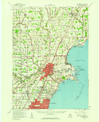
1952 Map of Mt Clemens
USGS Topo · Published 1959About this map
Anchor Bay and the western shores of Lake St. Clair define this landscape during a period of significant post-war expansion in Macomb County. The military presence at Selfridge Air Force Base stands as a massive landmark along the shoreline, while the growing urban centers of Mt Clemens, Roseville, and St Clair Shores reflect the northward spread of suburban development. Inland, the transition from agriculture to industry is evident, as local family farms and rural schoolhouses like Hall Sch and Shoemaker Sch sit near expanding infrastructure like McKinley Airport.
Find a feature on this map
128 named features on this map. Tap any name to fly to it.
Don’t see what you’re looking for? This feature index may not catch every label — zoom into the map to look around manually.
Map Details
Editions of this 1952 Mt Clemens Map
This is the sole edition of this map. No revisions or reprints were ever made.
Other maps of this area

1905 · Detroit
USGS Topo · 1:62,500

1905 · Grosse Pointe
USGS Topo · 1:62,500

1908 · Rochester
USGS Topo · 1:62,500

1912 · Mt Clemens
USGS Topo · 1:62,500

1914 · Armada
USGS Topo · 1:62,500

1914 · Algonac
USGS Topo · 1:62,500

1918 · Detroit
USGS Topo · 1:62,500

1918 · Grosse Pointe
USGS Topo · 1:62,500

1924 · Detroit
USGS Topo · 1:62,500

1928 · Armada
USGS Topo · 1:62,500