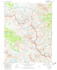
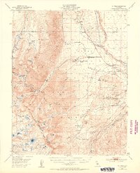
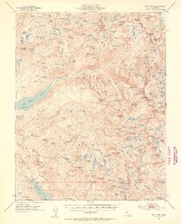
1983 Map of Mt. Darwin
USGS Topo · Published 1983About this map
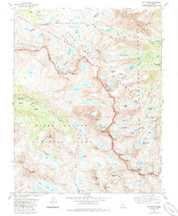
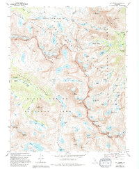
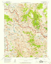
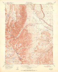
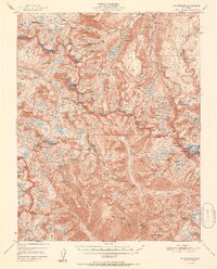
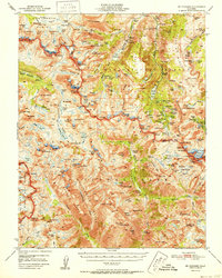
Mt Darwin and the high alpine crest of the Sierra Nevada dominate this 1983 survey, which captures a landscape defined by dramatic glaciation and wilderness conservation. The boundary between Kings Canyon National Park and the John Muir Wilderness follows the jagged ridgeline of the Glacier Divide, connecting peaks such as Mt Goethe and Mt Mendel. A primary thoroughfare for mountain travelers, the John Muir Pacific Crest National Scenic Trail winds through the southwestern sector, passing the McClure Meadow Ranger Station. The map highlights a concentration of active ice bodies, including the Goethe Glacier, Darwin Glacier, and Powell Glacier, alongside numerous tarns and basins like Humphreys Basin. From the headwaters of Piute Creek to the eastern lakes feeding the Middle Fork Bishop Creek, this record provides a precise look at the drainage patterns of the High Sierra before modern climate shifts significantly altered these perennial snowfields.
Find a feature on this map
85 named features on this map. Tap any name to fly to it.
Don’t see what you’re looking for? This feature index may not catch every label — zoom into the map to look around manually.
Map Details
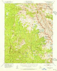
Editions of this 1983 Mt. Darwin Map
3 editions found
Other maps of this area

1912 · Mt. Goddard
USGS Topo · 1:125,000

1947 · Mariposa
USGS Topo · 1:250,000

1948 · Mariposa
USGS Topo · 1:250,000
1948 · Mt. Goddard
USGS Topo · 1:62,500
1949 · Mt. Tom
USGS Topo · 1:62,500
1951 · Mt. Tom
USGS Topo · 1:62,500
1951 · Mt. Goddard
USGS Topo · 1:62,500
1952 · Mt. Goddard
USGS Topo · 1:62,500
1953 · Mt Abbot
USGS Topo · 1:62,500
1953 · Blackcap Mtn
USGS Topo · 1:62,500