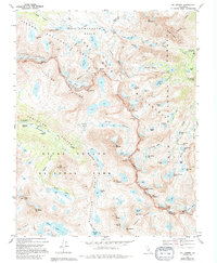
1983 Map of Mt. Darwin
USGS Topo · Published 1994About this map
The John Muir Trail winds through this high-altitude landscape where the borders of Kings Canyon National Park, Inyo National Forest, and Sierra National Forest converge. This survey documents a complex glaciated environment defined by the Glacier Divide and the massive peaks of Evolution Basin. Key mountain landmarks include Mt Darwin, Mt Mendel, and Mt Haeckel, which tower over a series of tarns and alpine meadows.
Find a feature on this map
93 named features on this map. Tap any name to fly to it.
Don’t see what you’re looking for? This feature index may not catch every label — zoom into the map to look around manually.
Map Details
Editions of this 1983 Mt. Darwin Map
3 editions found
Other maps of this area

1912 · Mt. Goddard
USGS Topo · 1:125,000

1947 · Mariposa
USGS Topo · 1:250,000

1948 · Mariposa
USGS Topo · 1:250,000

1948 · Mt. Goddard
USGS Topo · 1:62,500

1949 · Mt. Tom
USGS Topo · 1:62,500

1951 · Mt. Tom
USGS Topo · 1:62,500

1951 · Mt. Goddard
USGS Topo · 1:62,500

1952 · Mt. Goddard
USGS Topo · 1:62,500

1953 · Mt Abbot
USGS Topo · 1:62,500

1953 · Blackcap Mtn
USGS Topo · 1:62,500