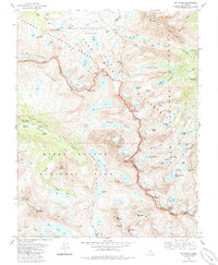
1983 Map of Mt. Darwin
USGS Topo · Published 1985About this map
Evolution Basin and the Glacier Divide form the core of this high-altitude survey, documenting the transition between the Sierra National Forest and Kings Canyon National Park. The landscape is defined by its glacial features, from the Goethe Glacier to the Mt Fiske Glacier, alongside the prominent peaks of the John Muir Wilderness. Mountaineers and backcountry researchers can trace the route of the John Muir Trail as it winds past McClure Meadow and the McClure Meadow Ranger Station. The map illustrates a complex network of alpine water bodies, including Goethe Lake, Wanda Lake, and the aptly named Hungry Packer Lake. This 1980s data records the topographical state of the Fresno and Inyo county line before modern shifts in glacial mass, providing a baseline for environmental historians and hikers studying the Piute Pass corridor and the surrounding crags.
Find a feature on this map
86 named features on this map. Tap any name to fly to it.
Don’t see what you’re looking for? This feature index may not catch every label — zoom into the map to look around manually.
Map Details
Editions of this 1983 Mt. Darwin Map
3 editions found
Other maps of this area

1912 · Mt. Goddard
USGS Topo · 1:125,000

1947 · Mariposa
USGS Topo · 1:250,000

1948 · Mariposa
USGS Topo · 1:250,000

1948 · Mt. Goddard
USGS Topo · 1:62,500

1949 · Mt. Tom
USGS Topo · 1:62,500

1951 · Mt. Tom
USGS Topo · 1:62,500

1951 · Mt. Goddard
USGS Topo · 1:62,500

1952 · Mt. Goddard
USGS Topo · 1:62,500

1953 · Mt Abbot
USGS Topo · 1:62,500

1953 · Blackcap Mtn
USGS Topo · 1:62,500