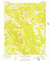
1955 Map of Mt. Day
USGS Topo · Published 1957About this map
Mt Day and the surrounding high country of the Diablo Range are documented here in the mid-1950s, capturing a landscape defined by steep drainages and remote encampments. The terrain is marked by significant elevations like Black Mtn and Mt Lewis, where the border between Alameda County and Santa Clara County follows the high ridgelines. Water systems are central to the geography, with Arroyo Honda and Alameda Creek carving deep paths through the hills, while the Cherry Flat Reservoir sits in the southwest corner. The map reveals the era's sparse human footprint, showing Old Camp and New Camp connected only by a network of primitive tracks, including the Reservoir Road and various unnamed jeep trails. Names like Van Horn Flats and Rattlesnake Butte reflect the local character of this upland territory before modern development reached these higher elevations.
Find a feature on this map
30 named features on this map. Tap any name to fly to it.
Don’t see what you’re looking for? This feature index may not catch every label — zoom into the map to look around manually.
Map Details
Editions of this 1955 Mt. Day Map
4 editions found
Other maps of this area

1889 · San Jose
USGS Topo · 1:62,500

1897 · San Jose
USGS Topo · 1:62,500

1897 · Mt. Hamilton
USGS Topo · 1:62,500

1899 · San Jose
USGS Topo · 1:62,500

1906 · Pleasanton
USGS Topo · 1:62,500

1907 · Tesla
USGS Topo · 1:62,500

1941 · Pleasanton
USGS Topo · 1:62,500

1942 · Mt. Hamilton
USGS Topo · 1:62,500

1942 · Altamont
USGS Topo · 1:62,500

1943 · Pleasanton
USGS Topo · 1:62,500