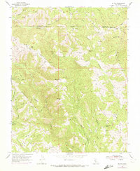
1955 Map of Mt. Day
USGS Topo · Published 1972About this map
The Diablo Range terrain of the Alameda and Santa Clara county line is defined by the steep watersheds of Arroyo Honda and Isabel Creek. This 1955 survey, updated with 1971 aerial data, captures the remote character of Camp Ohlone Regional Park and the high points of Mt Day and Black Mtn. The landscape is a network of ridges and flats, featuring Poverty Ridge and the broad Cañada de Pala.
Find a feature on this map
29 named features on this map. Tap any name to fly to it.
Don’t see what you’re looking for? This feature index may not catch every label — zoom into the map to look around manually.
Map Details
Editions of this 1955 Mt. Day Map
4 editions found
Other maps of this area

1889 · San Jose
USGS Topo · 1:62,500

1897 · San Jose
USGS Topo · 1:62,500

1897 · Mt. Hamilton
USGS Topo · 1:62,500

1899 · San Jose
USGS Topo · 1:62,500

1906 · Pleasanton
USGS Topo · 1:62,500

1907 · Tesla
USGS Topo · 1:62,500

1941 · Pleasanton
USGS Topo · 1:62,500

1942 · Mt. Hamilton
USGS Topo · 1:62,500

1942 · Altamont
USGS Topo · 1:62,500

1943 · Pleasanton
USGS Topo · 1:62,500