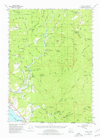
1954 Map of Mt. Emily
USGS Topo · Published 1977About this map
The Chetco River and Winchuck River systems carve through this heavily forested region of Curry County during the mid-1950s. The landscape is defined by its numerous prairies—openings in the timber such as Looking-glass Prairie, Yank Prairie, and Horse Prairie—which likely served as early focal points for grazing and settlement. Evidence of local ranching is preserved at Bravo Ranch and Tamba Ranch, while the Upper Chetco School reflects the presence of a rural community gathered near the riverbanks. High ridges like Backbone Ridge and peaks including Mt Emily overlook the dense canopy of the Siskiyou National Forest. Along the southern reaches near the California border, the Grissey Airport and protected groves within Redwood State Park mark the transition toward the coast and the settlement of Harbor.
Find a feature on this map
83 named features on this map. Tap any name to fly to it.
Don’t see what you’re looking for? This feature index may not catch every label — zoom into the map to look around manually.
Map Details
Editions of this 1954 Mt. Emily Map
3 editions found

Other maps of this area

1917 · Kerby
USGS Topo · 1:125,000

1918 · Kerby
USGS Topo · 1:125,000

1922 · Preston Peak
USGS Topo · 1:125,000

1929 · Crescent City
USGS Topo · 1:125,000

1945 · Kerby
USGS Topo · 1:125,000

1945 · Gasquet
USGS Topo · 1:62,500

1945 · Point St. George
USGS Topo · 1:62,500

1948 · Weed
USGS Topo · 1:250,000

1949 · Eureka
USGS Topo · 1:250,000

1950 · Weed
USGS Topo · 1:250,000