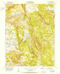
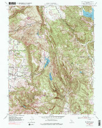
1951 Map of Mt. George
USGS Topo · Published 1952About this map
The rugged highlands of the Chimiles and Twin Sisters ranges dominate this 1951 topographic survey of the hills east of Napa. The landscape is defined by a series of steep canyons and water catchments, including Lake Madigan, Lake Frey, and Lake Marie, which serve the agricultural and domestic needs of the surrounding valleys. Civil engineering is evident in the water control structures of Suisun Reservoir and the Green Valley Falls, while the transition toward recreation and estate development is marked by the presence of the Napa Valley Country Club and the Green Valley Golf Club.
Find a feature on this map
50 named features on this map. Tap any name to fly to it.
Don’t see what you’re looking for? This feature index may not catch every label — zoom into the map to look around manually.
Map Details
Editions of this 1951 Mt. George Map
5 editions found
Other maps of this area

1896 · Carquinez Strait
USGS Topo · 1:62,500

1898 · Karquines
USGS Topo · 1:62,500

1901 · Karquines
USGS Topo · 1:62,500

1902 · Napa
USGS Topo · 1:125,000

1916 · Mare Island
USGS Topo · 1:62,500

1921 · Mt. Vaca
USGS Topo · 1:62,500

1940 · Carquinez Strait
USGS Topo · 1:62,500

1942 · Mare Island
USGS Topo · 1:62,500

1942 · Carquinez
USGS Topo · 1:62,500

1942 · Sonoma
USGS Topo · 1:62,500