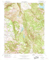
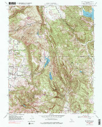
1951 Map of Mt. George
USGS Topo · Published 1969About this map
Mt George dominates the rugged divide between Napa and Solano Counties, where mid-century water management projects reshaped the local topography. This 1951 survey, updated with 1968 aerial revisions, documents the network of reservoirs including Lake Curry, Lake Madigan, and Lake Frey that served the growing populations in the valleys below. The transition from agricultural valley floors to steep ridgelines is marked by small settlements like Tulucay and Coombsville, while the Mt George Union Sch anchors the rural community near the Napa Valley Country Club.
Find a feature on this map
36 named features on this map. Tap any name to fly to it.
Don’t see what you’re looking for? This feature index may not catch every label — zoom into the map to look around manually.
Map Details
Editions of this 1951 Mt. George Map
5 editions found
Other maps of this area

1896 · Carquinez Strait
USGS Topo · 1:62,500

1898 · Karquines
USGS Topo · 1:62,500

1901 · Karquines
USGS Topo · 1:62,500

1902 · Napa
USGS Topo · 1:125,000

1916 · Mare Island
USGS Topo · 1:62,500

1921 · Mt. Vaca
USGS Topo · 1:62,500

1940 · Carquinez Strait
USGS Topo · 1:62,500

1942 · Mare Island
USGS Topo · 1:62,500

1942 · Carquinez
USGS Topo · 1:62,500

1942 · Sonoma
USGS Topo · 1:62,500