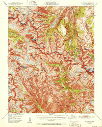
1951 Map of Mt. Goddard
USGS Topo · Published 1951About this map
The High Sierra backcountry of the early 1950s is defined by a network of high-altitude passes and recreation camps concentrated along the forks of Bishop Creek. In the east, established destinations like Andrews Camp, Bishop Park, and Camp Sabrina provide access to the Inyo National Forest, while the landscape further west transitions into the high-relief basins of Sierra National Forest. The map documents a transition from industrial activity to wilderness preservation, noting the Cardinal Mine (Inactive) alongside the Salty Peterson Mine and Schober Mine.
Find a feature on this map
161 named features on this map. Tap any name to fly to it.
Don’t see what you’re looking for? This feature index may not catch every label — zoom into the map to look around manually.
Map Details
Editions of this 1951 Mt. Goddard Map
2 editions found

Other maps of this area

1903 · Tehipite
USGS Topo · 1:125,000

1905 · Tehipite
USGS Topo · 1:125,000

1907 · Mt. Whitney
USGS Topo · 1:125,000

1912 · Mt. Goddard
USGS Topo · 1:125,000

1913 · Bishop
USGS Topo · 1:125,000

1919 · Mt. Whitney
USGS Topo · 1:125,000

1937 · Mt. Whitney
USGS Topo · 1:125,000

1947 · Mariposa
USGS Topo · 1:250,000

1948 · Fresno
USGS Topo · 1:250,000

1948 · Mariposa
USGS Topo · 1:250,000