
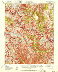
1951 Map of Mt. Goddard
USGS Topo · Published 1951About this map
Humphreys Basin and the high-altitude divide of the Sierra Nevada dominate this mid-century topographic study, which captures the rugged border between the Sierra National Forest and Inyo National Forest. The landscape is defined by its massive peaks, including Mt Goddard, Mt Darwin, and Mt Huxley, and the intricate glacial basins that feed the North Fork Bishop Creek and Middle Fork Bishop Creek.
Find a feature on this map
165 named features on this map. Tap any name to fly to it.
Don’t see what you’re looking for? This feature index may not catch every label — zoom into the map to look around manually.
Map Details
Editions of this 1951 Mt. Goddard Map
2 editions found
Other maps of this area

1903 · Tehipite
USGS Topo · 1:125,000

1905 · Tehipite
USGS Topo · 1:125,000

1907 · Mt. Whitney
USGS Topo · 1:125,000

1912 · Mt. Goddard
USGS Topo · 1:125,000

1913 · Bishop
USGS Topo · 1:125,000

1919 · Mt. Whitney
USGS Topo · 1:125,000

1937 · Mt. Whitney
USGS Topo · 1:125,000

1947 · Mariposa
USGS Topo · 1:250,000

1948 · Fresno
USGS Topo · 1:250,000

1948 · Mariposa
USGS Topo · 1:250,000