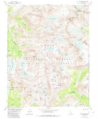
1982 Map of Mt. Hilgard
USGS Topo · Published 1982About this map
Mt Hilgard and Mount Julius Caesar anchor the high country of the High Sierra, where the John Muir Wilderness meets the boundary of Fresno and Inyo Counties. This 1982 map details a glacial landscape defined by numerous alpine basins, including the extensive chain of Seven Gables Lakes and the remarkably named cluster of ursine waters like Big Bear Lake, Little Bear Lake, and Teddy Bear Lake.
Find a feature on this map
91 named features on this map. Tap any name to fly to it.
Don’t see what you’re looking for? This feature index may not catch every label — zoom into the map to look around manually.
Map Details
Editions of this 1982 Mt. Hilgard Map
4 editions found
Other maps of this area

1912 · Mt. Goddard
USGS Topo · 1:125,000

1947 · Mariposa
USGS Topo · 1:250,000

1948 · Mariposa
USGS Topo · 1:250,000

1948 · Mt. Goddard
USGS Topo · 1:62,500

1949 · Mt. Tom
USGS Topo · 1:62,500

1951 · Mt. Tom
USGS Topo · 1:62,500

1951 · Mt. Goddard
USGS Topo · 1:62,500

1952 · Mt. Goddard
USGS Topo · 1:62,500

1953 · Mt Abbot
USGS Topo · 1:62,500

1953 · Blackcap Mtn
USGS Topo · 1:62,500