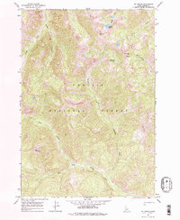
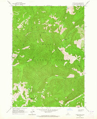
1964 Map of Mt Jordan
USGS Topo · Published 1978About this map
Mt Jordan and The General dominate this high-elevation landscape within the Challis National Forest, where the topography is defined by sharp ridges and drainages that feed the Salmon River watershed. In the early 1960s, the area remained largely roadless, characterized by a network of drainage systems including Lightning Creek, China Creek, and Tango Creek. The presence of several Prospects near the summit of Mt Jordan indicates a history of mineral exploration in these mountains, accessible by the Jordan Trail and a designated Jeep Trail. The southern portion of the map is defined by the West Fork Yankee Fork, a significant waterway that cuts through the base of Red Mountain. High alpine features like Mystery Lake and Lightning Lake reflect the glaciated character of the terrain, providing a detailed record of the wilderness as it was field checked in 1964.
Find a feature on this map
17 named features on this map. Tap any name to fly to it.
Don’t see what you’re looking for? This feature index may not catch every label — zoom into the map to look around manually.
Map Details
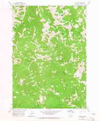
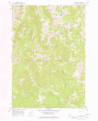
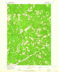
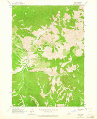
Editions of this 1964 Mt Jordan Map
3 editions found
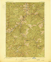
Other maps of this area

1919 · Custer
USGS Topo · 1:125,000

1922 · Custer
USGS Topo · 1:125,000
1930 · Casto
USGS Topo · 1:125,000

1957 · Challis
USGS Topo · 1:250,000

1960 · Challis
USGS Topo · 1:250,000

1963 · Challis
USGS Topo · 1:250,000
1963 · Pinyon Peak
USGS Topo · 1:24,000
1963 · Custer
USGS Topo · 1:24,000
1963 · Casto
USGS Topo · 1:24,000
1963 · Basin Butte
USGS Topo · 1:24,000