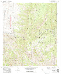
1981 Map of Mt. Lemmon
USGS Topo · Published 1984About this map
Santa Catalina Mountains dominate this 1981 survey of the high-elevation peaks north of Tucson, centered on the summit of Mt Lemmon. The settlement of Summerhaven and the residential area of Loma Linda provide a rare look at the mountain community's layout before later fires significantly altered the landscape. Infrastructure supporting the summit includes the Mt Lemmon Observatory and a network of radio towers and a Heliport, reflecting the peak's importance for both scientific research and communications.
Find a feature on this map
65 named features on this map. Tap any name to fly to it.
Don’t see what you’re looking for? This feature index may not catch every label — zoom into the map to look around manually.
Map Details
Editions of this 1981 Mt. Lemmon Map
3 editions found
Other maps of this area

1904 · Tucson
USGS Topo · 1:125,000

1905 · Tucson
USGS Topo · 1:125,000

1911 · Winkelman
USGS Topo · 1:125,000

1913 · Winkelman
USGS Topo · 1:125,000

1948 · Mammoth
USGS Topo · 1:62,500

1948 · Campo Bonito
USGS Topo · 1:24,000

1949 · Campo Bonito
USGS Topo · 1:24,000
1951 · Mammoth
USGS Topo · 1:62,500

1956 · Tucson
USGS Topo · 1:250,000

1957 · Bellota Ranch
USGS Topo · 1:62,500