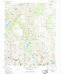
1983 Map of Mt. Thompson
USGS Topo · Published 1988About this map
Aspendell sits at the northern end of this high-elevation landscape, where the North Fork Bishop Creek and Middle Fork Bishop Creek drain from the dramatic crests of the Inconsolable Range. The area is characterized by heavy water management infrastructure, evidenced by Intake No 2 and the large reservoirs of Lake Sabrina and South Lake, which support downstream power and irrigation needs. High-altitude mining history is visible through the Cardinal Mine and Salty Peterson Mine, alongside several prospects like the Merrill Prospect.
Find a feature on this map
92 named features on this map. Tap any name to fly to it.
Don’t see what you’re looking for? This feature index may not catch every label — zoom into the map to look around manually.
Map Details
Editions of this 1983 Mt. Thompson Map
4 editions found
Other maps of this area

1912 · Mt. Goddard
USGS Topo · 1:125,000

1913 · Bishop
USGS Topo · 1:125,000

1947 · Mariposa
USGS Topo · 1:250,000

1948 · Mariposa
USGS Topo · 1:250,000

1948 · Mt. Goddard
USGS Topo · 1:62,500

1949 · Mt. Tom
USGS Topo · 1:62,500

1949 · Bishop
USGS Topo · 1:62,500

1950 · Big Pine
USGS Topo · 1:62,500

1951 · Mt. Tom
USGS Topo · 1:62,500

1951 · Mt. Goddard
USGS Topo · 1:62,500