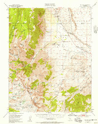
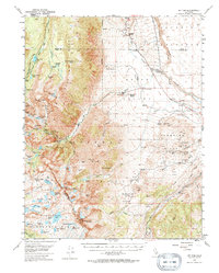
1949 Map of Mt. Tom
USGS Topo · Published 1958About this map
Tungsten extraction dominates the eastern slopes of the Sierra Nevada in this late 1940s survey. The concentration of industrial activity is centered around the Pine Creek Tungsten Mill and the nearby Scheelite settlement, supporting numerous operations like the Adamson Mine, Brownstone Mine, and the Tungstar Mine. This industrial footprint contrasts sharply with the high-altitude wilderness of the Inyo National Forest, where a network of glacial lakes including Pine Lake, Horton Lake, and Rock Creek Lake dot the granite basins.
Find a feature on this map
98 named features on this map. Tap any name to fly to it.
Don’t see what you’re looking for? This feature index may not catch every label — zoom into the map to look around manually.
Map Details
Editions of this 1949 Mt. Tom Map
6 editions found
Other maps of this area

1912 · Mt. Goddard
USGS Topo · 1:125,000

1913 · Bishop
USGS Topo · 1:125,000

1914 · Mt. Morrison
USGS Topo · 1:125,000

1917 · White Mountain
USGS Topo · 1:125,000

1947 · Mariposa
USGS Topo · 1:250,000

1948 · Mariposa
USGS Topo · 1:250,000

1948 · Mt. Goddard
USGS Topo · 1:62,500

1949 · Mt. Tom
USGS Topo · 1:62,500

1949 · Bishop
USGS Topo · 1:62,500

1950 · Big Pine
USGS Topo · 1:62,500