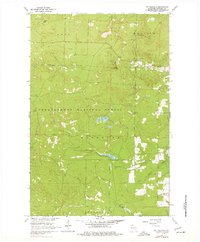
1964 Map of Mt. Valhalla
USGS Topo · Published 1977About this map
Mt Valhalla rises as a central landmark within the Chequamegon National Forest, anchoring a landscape defined by timber management and recreation in the mid-1960s. This survey, photoinspected in the 1970s, captures the area's transition into a recreational hub, featuring a Ski Area and a Picnic Area near Long Lake. The infrastructure of the previous logging era remains visible through several sections of Old Railroad Grade that snake through the townships of Washburn and Barksdale.
Find a feature on this map
19 named features on this map. Tap any name to fly to it.
Don’t see what you’re looking for? This feature index may not catch every label — zoom into the map to look around manually.
Map Details
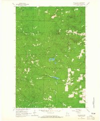
Editions of this 1964 Mt. Valhalla Map
3 editions found

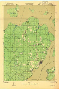
Other maps of this area

1941 · Bayfield
USGS Topo · 1:48,000

1942 · Ashland
USGS Topo · 1:48,000

1944 · Moquah
USGS Topo · 1:48,000

1944 · Cornucopia
USGS Topo · 1:48,000

1946 · Cornucopia
USGS Topo · 1:48,000
1946 · Bayfield
USGS Topo · 1:48,000

1947 · Moquah
USGS Topo · 1:48,000

1947 · Ashland
USGS Topo · 1:48,000

1953 · Ashland
USGS Topo · 1:250,000

1958 · Ashland
USGS Topo · 1:250,000