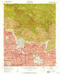
1953 Map of Mt. Wilson
USGS Topo · Published 1958About this map
The southern slopes of the San Gabriel Mountains rise sharply above the expanding suburbs of the Los Angeles basin in this mid-century survey. Established residential grids in Altadena, Pasadena, and Arcadia are shown in high detail, featuring academic landmarks like the Calif Institute of Technology and Pasadena City College. To the east, the Santa Anita Park racetrack and the Santa Anita Golf Course anchor the community layout.
Find a feature on this map
147 named features on this map. Tap any name to fly to it.
Don’t see what you’re looking for? This feature index may not catch every label — zoom into the map to look around manually.
Map Details
Editions of this 1953 Mt. Wilson Map
3 editions found
Other maps of this area

1894 · Los Angeles
USGS Topo · 1:62,500

1894 · Pomona
USGS Topo · 1:62,500

1896 · Pasadena
USGS Topo · 1:62,500

1897 · Pomona
USGS Topo · 1:62,500

1898 · Pomona
USGS Topo · 1:62,500

1900 · Pasadena
USGS Topo · 1:62,500

1900 · Tujunga
USGS Topo · 1:62,500

1900 · Los Angeles
USGS Topo · 1:62,500

1901 · Southern California Sheet No. 1
USGS Topo · 1:250,000

1903 · Rock Creek
USGS Topo · 1:62,500