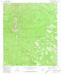
1981 Map of Mt. Wrightson
USGS Topo · Published 1981About this map
Santa Rita Mountains dominate this 1981 survey, where the rugged peaks of Mt Wrightson and Josephine Peak overlook a landscape deeply marked by Arizona's mining history. The map documents an extensive network of mineral extraction sites across the Coronado National Forest, ranging from the Silver King Mine and East Compadre Shaft in the south to the Snyder Mine in the northeast. The presence of numerous named shafts and mines, including the Philadelphia Mine and Arizona-Pittsburg Mine, illustrates the intensity of prospecting within the canyons.
Find a feature on this map
71 named features on this map. Tap any name to fly to it.
Don’t see what you’re looking for? This feature index may not catch every label — zoom into the map to look around manually.
Map Details
Editions of this 1981 Mt. Wrightson Map
2 editions found
Other maps of this area

1904 · Patagonia
USGS Topo · 1:125,000

1905 · Patagonia
USGS Topo · 1:125,000

1922 · Agus Caliente
USGS Topo · 1:62,500

1926 · Helvetia
USGS Topo · 1:62,500

1932 · Elgin
USGS Topo · 1:62,500

1940 · Elgin
USGS Topo · 1:62,500

1947 · Elgin
USGS Topo · 1:62,500

1948 · Sonoita
USGS Topo · 1:24,000
1948 · Mt. Hughes
USGS Topo · 1:24,000

1956 · Nogales
USGS Topo · 1:250,000