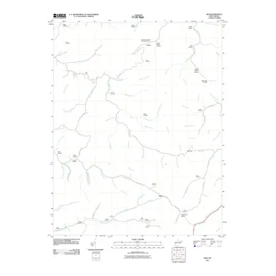
2011 Map of Mud
USGS Topo · Published 2011About this map
Mud and Cameo represent the primary settlements in this Appalachian landscape, where life and industry follow the intricate drainage patterns of the Mud River. The region's genealogy is deeply etched into the hills, with an exceptional concentration of family burial grounds such as Smith Cemetery, Antill Cemetery, and Stanley Cemetery overlooking the numerous branches and hollows. Human impact on the land is most visible at the Jack Smith Branch Refuse Bank Dam near Cameo, signaling the industrial presence within the steep terrain. Movement through the area relies on a network of winding valley roads, including Mud River Rd and Big Ugly Rd E, which connect isolated communities like Dollie and Estep. The terrain is defined by its named hollows—from Boone Block Hollow to Sugarcamp Hollow—serving as landmarks for residents navigate the dense network of forks and runs.
Find a feature on this map
100 named features on this map. Tap any name to fly to it.
Don’t see what you’re looking for? This feature index may not catch every label — zoom into the map to look around manually.
Map Details
Editions of this 2011 Mud Map
This is the sole edition of this map. No revisions or reprints were ever made.
Other maps of this area

1887 · Warfield
USGS Topo · 1:125,000

1891 · Oceana
USGS Topo · 1:125,000

1891 · Warfield
USGS Topo · 1:125,000

1892 · Huntington
USGS Topo · 1:125,000

1893 · Oceana
USGS Topo · 1:125,000

1898 · Huntington
USGS Topo · 1:125,000

1898 · Oceana
USGS Topo · 1:125,000

1899 · Charleston
USGS Topo · 1:125,000

1902 · Midkiff
USGS Topo · 1:62,500

1907 · Midkiff
USGS Topo · 1:62,500