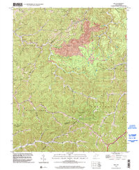
1996 Map of Mud
USGS Topo · Published 2002About this map
Cameo (Garner Sta) and the settlement of Mud anchor this West Virginia landscape, where the borders of Boone, Lincoln, and Logan counties converge. The terrain is deeply defined by narrow hollows and the winding course of the Mud River, with an economy heavily influenced by the extraction industry, visible through a large Strip Mine, a Compressor Station, and a network of Gas Wells and Pipeline routes. Local social life is mapped through several community landmarks, including the North Fork Church and a series of rural schools such as Stanley Sch and Dollie Sch.
Find a feature on this map
104 named features on this map. Tap any name to fly to it.
Don’t see what you’re looking for? This feature index may not catch every label — zoom into the map to look around manually.
Map Details
Editions of this 1996 Mud Map
This is the sole edition of this map. No revisions or reprints were ever made.
Other maps of this area

1887 · Warfield
USGS Topo · 1:125,000

1891 · Oceana
USGS Topo · 1:125,000

1891 · Warfield
USGS Topo · 1:125,000

1892 · Huntington
USGS Topo · 1:125,000

1893 · Oceana
USGS Topo · 1:125,000

1898 · Huntington
USGS Topo · 1:125,000

1898 · Oceana
USGS Topo · 1:125,000

1899 · Charleston
USGS Topo · 1:125,000

1902 · Midkiff
USGS Topo · 1:62,500

1907 · Midkiff
USGS Topo · 1:62,500