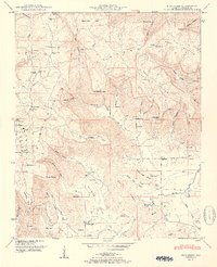
1951 Map of Mud Creek
USGS Topo · Published 1951About this map
The Cumberland Plateau dominates this portion of Jackson County, where the landscape is defined by the steep escarpments of Crow Mountain and deep incisions like Peacock Hollow and Goshen Hollow. In the valley floor, the rural community is anchored by small agrarian settlements and centers of worship, including Holland Chapel and Fairfield Church. The mapping reveals a high density of small family cemeteries and neighborhood schools, such as Kyles Sch No 2 and Tupelo Sch, which suggest a localized social structure common to North Alabama in the mid-century. Geologic features are prominent throughout the terrain, notably Blowing Cave and Coffey Cave along the base of the ridges. The settlement at Maynard Cove sits at a strategic point where the plateau gives way to the lower basin of Mud Creek, illustrating the historical reliance on these level cove lands for agriculture and community building.
Find a feature on this map
81 named features on this map. Tap any name to fly to it.
Don’t see what you’re looking for? This feature index may not catch every label — zoom into the map to look around manually.
Map Details
Editions of this 1951 Mud Creek Map
2 editions found
Other maps of this area

1886 · Stevenson
USGS Topo · 1:125,000

1888 · Scottsboro
USGS Topo · 1:125,000

1892 · Scottsboro
USGS Topo · 1:125,000

1892 · Stevenson
USGS Topo · 1:125,000

1895 · Stevenson
USGS Topo · 1:125,000

1936 · Scottsboro
USGS Topo · 1:24,000

1936 · Wannville
USGS Topo · 1:24,000

1936 · Mud Creek
USGS Topo · 1:24,000

1936 · Hytop
USGS Topo · 1:24,000

1936 · Princeton
USGS Topo · 1:24,000