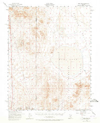
1952 Map of Mud Lake
USGS Topo · Published 1965About this map
Las Vegas Bombing and Gunnery Range occupies a significant portion of this landscape, reflecting the heavy military and industrial footprint of mid-century Nevada. The topography is defined by the expansive Ralston Valley and the dry bed of Mud Lake, punctuated by prominent peaks such as Kendall Mtn and McMahon Ridge. The map documents a transition from old-world extraction to federal control, showing a Dismantled Railroad that once connected these remote basins to larger mining hubs.
Find a feature on this map
16 named features on this map. Tap any name to fly to it.
Don’t see what you’re looking for? This feature index may not catch every label — zoom into the map to look around manually.
Map Details
Editions of this 1952 Mud Lake Map
2 editions found
Other maps of this area

1907 · Tonopah
USGS Topo · 1:250,000

1908 · Kawich
USGS Topo · 1:250,000

1908 · Lida
USGS Topo · 1:250,000

1908 · Tonopah
USGS Topo · 1:250,000

1913 · Lida
USGS Topo · 1:250,000

1942 · Cactus Range
USGS Topo · 1:125,000

1945 · Goldfield
USGS Topo · 1:125,000

1952 · Cactus Spring
USGS Topo · 1:62,500

1952 · Mud Lake
USGS Topo · 1:62,500

1952 · Goldfield
USGS Topo · 1:62,500