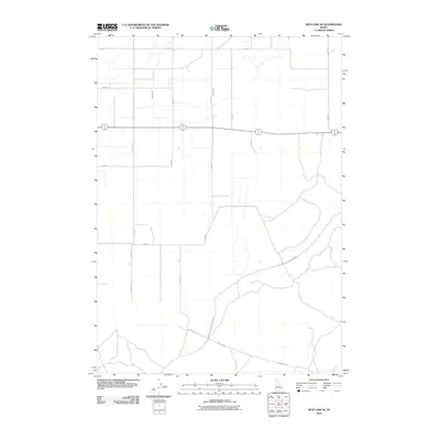
2010 Map of Mud Lake SE
USGS Topo · Published 2010About this map
Jackett Canal and Holly Canal define the irrigation-led agricultural patterns of this Jefferson County landscape during the early 21st century. The map reveals a transition from a highly structured northern grid of section roads, such as E 1700 N and N 1700 E, to a more open southern expanse where specialized routes like Twin Butte Sage Junction Rd and Mud Lake Rd navigate the terrain. This spatial arrangement reflects the region's dependence on canal water for cultivation, contrasted with the open sagebrush or grazing lands that flank the more flexible road networks to the south. Local transit and access are facilitated by named connectors including Boytt Rd and Roberts Rd, highlighting the functional layout of a rural Idaho community focused on water management and land use efficiency.
Find a feature on this map
17 named features on this map. Tap any name to fly to it.
Don’t see what you’re looking for? This feature index may not catch every label — zoom into the map to look around manually.
Map Details
Editions of this 2010 Mud Lake SE Map
This is the sole edition of this map. No revisions or reprints were ever made.
Other maps of this area

1949 · Roberts
USGS Topo · 1:62,500

1949 · Roberts
USGS Topo · 1:24,000

1950 · Roberts
USGS Topo · 1:24,000

1955 · Idaho Falls
USGS Topo · 1:250,000

1958 · Idaho Falls
USGS Topo · 1:250,000

1964 · Kettle Butte NE
USGS Topo · 1:24,000

1964 · Kettle Butte NW
USGS Topo · 1:24,000

1964 · Terreton
USGS Topo · 1:24,000
1964 · Market Lake
USGS Topo · 1:24,000

1964 · Mud Lake SE
USGS Topo · 1:24,000