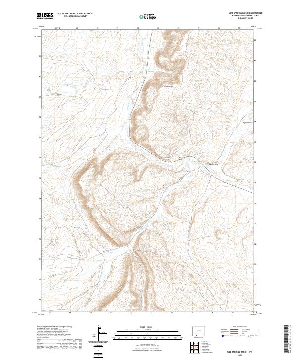
2021 Map of Mud Springs Ranch
USGS Topo · Published 2021About this map
Mud Springs Ranch sits at a junction of high-desert drainage systems and ranch roads in this modern topographical study of Sweetwater County. The landscape is defined by the prominent Cooper Ridge, which separates the winding path of Salt Wells Cr from the expansive Big Flat Draw. The drainage network includes several intermittently flowing features like Pretty Water Cr, Joyce Cr, and Dans Cr, suggesting a terrain shaped by seasonal water movement through the arid basin.
Find a feature on this map
18 named features on this map. Tap any name to fly to it.
Don’t see what you’re looking for? This feature index may not catch every label — zoom into the map to look around manually.
Map Details
Editions of this 2021 Mud Springs Ranch Map
This is the sole edition of this map. No revisions or reprints were ever made.
Other maps of this area

1954 · Rock Springs
USGS Topo · 1:250,000

1958 · Rock Springs
USGS Topo · 1:250,000

1962 · Rock Springs
USGS Topo · 1:250,000
1963 · Titsworth Gap
USGS Topo · 1:24,000
1963 · Potter Mountain
USGS Topo · 1:24,000

1963 · Erickson-Kent Ranch
USGS Topo · 1:24,000

1968 · Cooper Ridge NE
USGS Topo · 1:24,000

1968 · Mud Springs Ranch
USGS Topo · 1:24,000
1968 · South Baxter
USGS Topo · 1:24,000

1968 · Camel Rock
USGS Topo · 1:24,000