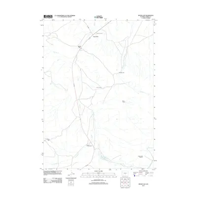
2012 Map of Muddy Gap
USGS Topo · Published 2012About this map
Muddy Gap serves as a central hub for this high-desert Wyoming landscape, where the convergence of drainage systems and early transportation routes define the settlement pattern. The map reveals a ranching and homesteading history through sites like the George Tully Homestead and the Sharp 47 Ranch, illustrating how water sources like Muddy Cr and Brady Cr dictated the placement of early dwellings in Carbon County. Terrain features such as Whiskey Gap and Black Canyon mark the natural corridors used to navigate this open country. To the south, the presence of the Hanna Mahoney Reservoir Number 2 highlights the regional importance of water management, while names like Three Forks and Muddy Gap Junction emphasize the area's role as a vital waypoint for travelers and local residents alike.
Find a feature on this map
19 named features on this map. Tap any name to fly to it.
Don’t see what you’re looking for? This feature index may not catch every label — zoom into the map to look around manually.
Map Details
Editions of this 2012 Muddy Gap Map
This is the sole edition of this map. No revisions or reprints were ever made.
Other maps of this area

1951 · Savage Peak
USGS Topo · 1:24,000

1951 · Bucklin Reservoirs
USGS Topo · 1:24,000

1951 · Split Rock
USGS Topo · 1:24,000

1955 · Casper
USGS Topo · 1:250,000

1958 · Casper
USGS Topo · 1:250,000

1961 · Lamont NE
USGS Topo · 1:24,000

1961 · Lamont
USGS Topo · 1:24,000

1961 · Bairoil
USGS Topo · 1:24,000

1962 · Casper
USGS Topo · 1:250,000

1962 · Whiskey Peak
USGS Topo · 1:24,000