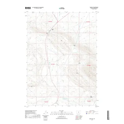
2018 Map of Muddy Gap
USGS Topo · Published 2018About this map
Muddy Gap serves as a critical geographic bottleneck in the Wyoming landscape, where high-desert plains meet the rising slopes of the Ferris Mountains. This 2018 survey illustrates the persistent importance of this natural passage for modern infrastructure and water management. To the south, the Hanna Mahoney Reservoir Number Two and Indian Creek Meadow highlight how water is collected and utilized in this arid environment, fed by drainages such as Muddy Cr and Whiskey Cr. The map details the complex topography of the Red Hills and Black Canyon, areas defined by sharp elevation changes and seasonal watercourses. The inclusion of Ferris Mtn Ranch Rd and local landmarks like Bunker Hill provide essential reference points for researchers interested in the rural land use and ranching history of Carbon County.
Find a feature on this map
24 named features on this map. Tap any name to fly to it.
Don’t see what you’re looking for? This feature index may not catch every label — zoom into the map to look around manually.
Map Details
Editions of this 2018 Muddy Gap Map
This is the sole edition of this map. No revisions or reprints were ever made.
Other maps of this area

1951 · Savage Peak
USGS Topo · 1:24,000

1951 · Bucklin Reservoirs
USGS Topo · 1:24,000

1951 · Split Rock
USGS Topo · 1:24,000

1955 · Casper
USGS Topo · 1:250,000

1958 · Casper
USGS Topo · 1:250,000

1961 · Lamont NE
USGS Topo · 1:24,000

1961 · Lamont
USGS Topo · 1:24,000

1961 · Bairoil
USGS Topo · 1:24,000

1962 · Casper
USGS Topo · 1:250,000

1962 · Whiskey Peak
USGS Topo · 1:24,000