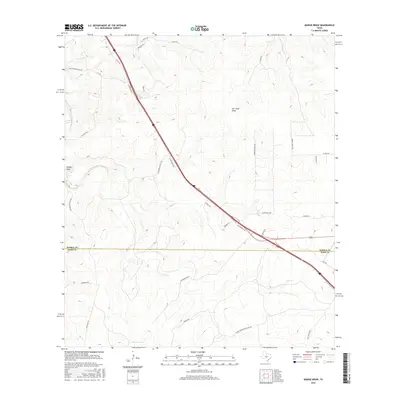
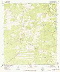
2016 Map of Mudge Draw
USGS Topo · Published 2016About this map
Mudge Draw and Jim Little Draw define the drainage patterns across this portion of the Edwards Plateau, where the landscape is carved by seasonal watercourses and intermittent basins. The map illustrates a contemporary ranching environment partitioned by an extensive network of named roads, including Rio Bonita Ranch Rd, Carlton Ranch Rd, and Stapp Ranch Rd. These routes provide access to remote acreage and water sources like Roach Lake, East Spring, and The Dirt Tank. The boundary between Kimble and Kerr counties cuts across the southern half of the sheet, while Interstate 10 serves as the primary modern thoroughfare. For local historians and land researchers, the inclusion of specific property-access roads such as Tommy Burrus Ranch Rd NW and Old Segovia Wulbs Rd offers a detailed view of current land use and rural connectivity in the Texas Hill Country.
Find a feature on this map
34 named features on this map. Tap any name to fly to it.
Don’t see what you’re looking for? This feature index may not catch every label — zoom into the map to look around manually.
Map Details
Editions of this 2016 Mudge Draw Map
This is the sole edition of this map. No revisions or reprints were ever made.
Other maps of this area

1894 · Kerrville
USGS Topo · 1:125,000

1954 · Llano
USGS Topo · 1:250,000

1955 · Llano
USGS Topo · 1:250,000

1956 · Llano
USGS Topo · 1:250,000

1963 · Y O Ranch
USGS Topo · 1:24,000
1964 · Contrary Creek
USGS Topo · 1:24,000

1964 · Live Oak Ranch
USGS Topo · 1:24,000
1974 · Noxville
USGS Topo · 1:24,000
1974 · Tobe Branch
USGS Topo · 1:24,000
1974 · Allen Creek
USGS Topo · 1:24,000