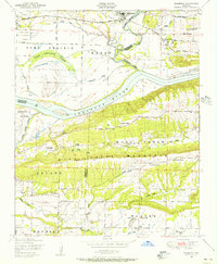
1948 Map of Mulberry
USGS Topo · Published 1956About this map
The Mulberry River winds through the northern landscape of this survey, joining the Arkansas River near the western edge of Mill Creek Mountain. In the late 1940s, the town of Mulberry serves as a local hub, supported by the Missouri Pacific railroad. The lowlands between the rivers are characterized by intricate water features like Vine Prairie Lake and Court House Slough, which define the agricultural limits of Vine Prairie and Maxey.
Find a feature on this map
41 named features on this map. Tap any name to fly to it.
Don’t see what you’re looking for? This feature index may not catch every label — zoom into the map to look around manually.
Map Details
Editions of this 1948 Mulberry Map
4 editions found
Other maps of this area

1879 · Cravens
USGS Topo · 1:62,500

1887 · Magazine Mountain #2
USGS Topo · 1:62,500

1887 · Watalula
USGS Topo · 1:62,500

1887 · Magazine Mountain
USGS Topo · 1:62,500

1890 · Magazine Mountain
USGS Topo · 1:125,000

1890 · Fort Smith
USGS Topo · 1:125,000

1898 · Winslow #4
USGS Topo · 1:62,500

1898 · Winslow
USGS Topo · 1:125,000

1901 · Winslow
USGS Topo · 1:125,000

1906 · Lavaca
USGS Topo · 1:62,500