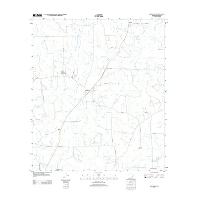
2013 Map of Muldoon
USGS Topo · Published 2013About this map
Muldoon serves as the central hub of this Fayette County landscape, where the local economy is defined by a mix of agriculture and energy extraction. The Muldoon Oil Field sits to the southwest near the small settlement of Floy, illustrating the continued importance of the petroleum industry in this part of Texas. Further north, the Cherry Spraying Service Airport highlights the role of aerial application in local farming operations.
Find a feature on this map
52 named features on this map. Tap any name to fly to it.
Don’t see what you’re looking for? This feature index may not catch every label — zoom into the map to look around manually.
Map Details
Editions of this 2013 Muldoon Map
This is the sole edition of this map. No revisions or reprints were ever made.
Other maps of this area

1901 · Flatonia
USGS Topo · 1:125,000

1919 · Schulenburg
USGS Topo · 1:62,500

1953 · Seguin
USGS Topo · 1:250,000

1956 · La Grange
USGS Topo · 1:62,500

1958 · La Grange West
USGS Topo · 1:24,000
1958 · West Point
USGS Topo · 1:24,000

1958 · Seguin
USGS Topo · 1:250,000
1964 · Togo
USGS Topo · 1:24,000

1965 · Muldoon
USGS Topo · 1:24,000

1965 · Schulenburg
USGS Topo · 1:24,000