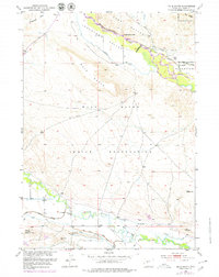
1951 Map of Mule Butte
USGS Topo · Published 1978About this map
Wind River Indian Reservation lands dominate this central Wyoming landscape, where the confluence of complex irrigation engineering and natural watercourses shaped mid-century settlement. The Wind River and Little Wind River are the primary arteries here, redirected through the Riverton Reclamation Project and the Le Clair Canal. This network of man-made waterways, including the Ethete Ditch and Blackburn Ditch, illustrates the intensive efforts to reclaim the arid Johnstown Valley for agriculture.
Find a feature on this map
38 named features on this map. Tap any name to fly to it.
Don’t see what you’re looking for? This feature index may not catch every label — zoom into the map to look around manually.
Map Details
Editions of this 1951 Mule Butte Map
4 editions found
Other maps of this area

1950 · Pavillion
USGS Topo · 1:24,000

1950 · Ocean Lake
USGS Topo · 1:24,000

1951 · Mule Butte
USGS Topo · 1:24,000

1951 · Pavillion SE
USGS Topo · 1:24,000

1951 · Morton
USGS Topo · 1:24,000

1951 · Ethete
USGS Topo · 1:24,000

1952 · Hudson
USGS Topo · 1:24,000

1952 · Ray Lake
USGS Topo · 1:24,000

1952 · Lander NW
USGS Topo · 1:24,000

1955 · Thermopolis
USGS Topo · 1:250,000