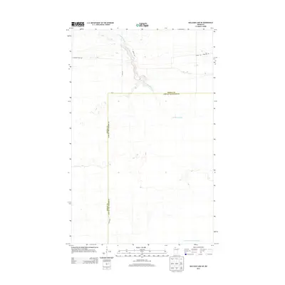
2013 Map of Mulligan Lake NE
USGS Topo · Published 2013About this map
W Br Warroad River meanders through the northern reaches of this landscape, marking a terrain defined by extensive drainage systems and forest access routes. The boundary between Roseau Co and Lake of the Woods Co bisects the region, reflecting the administrative divisions of northern Minnesota. This area is characterized by a network of specialized roads and trails, including Thompson Forest Rd, Dicks Pkwy, and Bednar Trl, which provide access to the timbered interior. Genealogists and local historians will note the presence of Pine Ridge Cem in the northeast, a localized landmark in an otherwise low-density area. The southern portion of the sheet is dominated by the Judicial Ditch Number Sixtytwo, a major water management feature indicative of the regional effort to regulate wetlands for land use.
Find a feature on this map
8 named features on this map. Tap any name to fly to it.
Don’t see what you’re looking for? This feature index may not catch every label — zoom into the map to look around manually.
Map Details
Editions of this 2013 Mulligan Lake NE Map
This is the sole edition of this map. No revisions or reprints were ever made.
Other maps of this area

1918 · Winterroad
USGS Topo · 1:62,500

1918 · Roosevelt
USGS Topo · 1:62,500

1918 · Warroad
USGS Topo · 1:62,500

1943 · Roosevelt
USGS Topo · 1:62,500

1943 · Warroad
USGS Topo · 1:62,500

1954 · Roseau
USGS Topo · 1:250,000

1957 · Roseau
USGS Topo · 1:250,000

1958 · Roseau
USGS Topo · 1:250,000
1967 · Warroad SE
USGS Topo · 1:24,000
1967 · Warroad SW
USGS Topo · 1:24,000