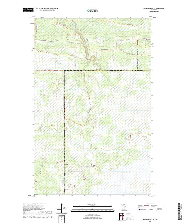
2022 Map of Mulligan Lake NE
USGS Topo · Published 2022About this map
The W Br Warroad River winds through this expanse of Lake of the Woods and Roseau counties, defining a landscape largely shaped by water and forest management. This 2022 survey documents a sparsely populated but active corridor of the northern borderlands, where extensive networks of trails and forest roads intersect. The confluence of the Bemis Hill Trails Trl and the Warroad/Roseau Trails Trl suggests a region dedicated to conservation and recreational transit. Local history is anchored at the Pine Ridge Cem in the northeastern corner, one of the few named landmarks of permanent settlement in an area otherwise dominated by forestry infrastructure like Thompson Forest Rd and Hiwood Forest Rd. The boundary between Roseau and Lake of the Woods counties bisects the quadrangle, illustrating the jurisdictional division of these vast wetlands and timberlands.
Find a feature on this map
18 named features on this map. Tap any name to fly to it.
Don’t see what you’re looking for? This feature index may not catch every label — zoom into the map to look around manually.
Map Details
Editions of this 2022 Mulligan Lake NE Map
This is the sole edition of this map. No revisions or reprints were ever made.
Other maps of this area

1918 · Winterroad
USGS Topo · 1:62,500

1918 · Roosevelt
USGS Topo · 1:62,500

1918 · Warroad
USGS Topo · 1:62,500

1943 · Roosevelt
USGS Topo · 1:62,500

1943 · Warroad
USGS Topo · 1:62,500

1954 · Roseau
USGS Topo · 1:250,000

1957 · Roseau
USGS Topo · 1:250,000

1958 · Roseau
USGS Topo · 1:250,000
1967 · Warroad SE
USGS Topo · 1:24,000
1967 · Warroad SW
USGS Topo · 1:24,000