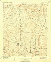
1950 Map of Mullin
USGS Topo · Published 1950About this map
The Gulf Colorado and Santa Fe railroad serves as the primary spine of activity in this 1950 survey, connecting the town of Mullin to smaller siding points like Villa Siding. The landscape is a network of rural school districts and family landmarks, featuring Prairie Sch, Duren Sch, and Center Point Sch alongside historical burial grounds like Rock Springs Cem and Dudley Cem.
Find a feature on this map
55 named features on this map. Tap any name to fly to it.
Don’t see what you’re looking for? This feature index may not catch every label — zoom into the map to look around manually.
Map Details
Editions of this 1950 Mullin Map
2 editions found

Other maps of this area

1885 · San Saba
USGS Topo · 1:125,000

1887 · Lampasas
USGS Topo · 1:125,000

1888 · Hamilton
USGS Topo · 1:125,000

1889 · Brownwood
USGS Topo · 1:125,000

1894 · Hamilton
USGS Topo · 1:125,000

1894 · Lampasas
USGS Topo · 1:125,000

1894 · Brownwood
USGS Topo · 1:125,000

1894 · San Saba
USGS Topo · 1:125,000

1925 · San Saba 2-a
USGS Topo · 1:48,000

1925 · Brownwood 3-d
USGS Topo · 1:48,000