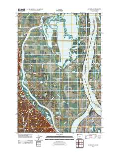
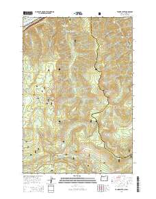
1986 Map of Multnomah Falls
USGS Topo · Published 1986About this map
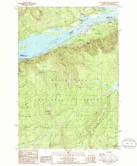
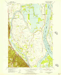
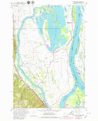
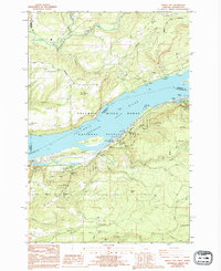
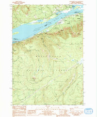
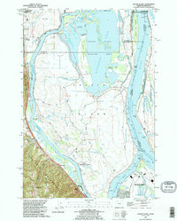
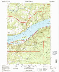
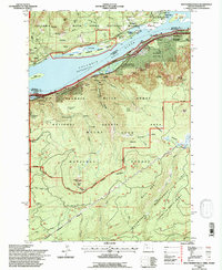
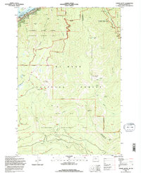
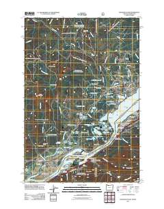
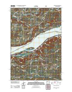
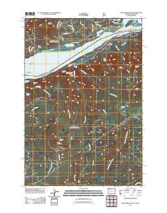
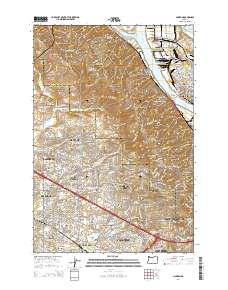
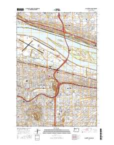
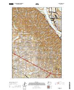
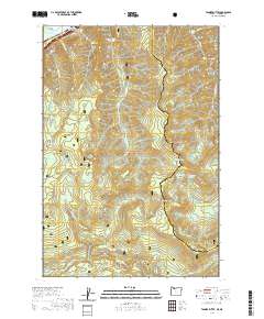
Multnomah Falls and the dramatic verticality of the Columbia River Gorge dominate this mid-1980s survey, illustrating the convergence of natural wonders and transportation infrastructure. Along the Broughton Reach, the Historic Columbia River Highway and Route 84 trace the river's edge, connecting small communities like Dodson and Warrendale. The map provides a detailed view of the rugged terrain within the Mount Hood National Forest, where numerous cataracts including Oneonta Falls, Triple Falls, and Horsetail Falls drop from the high basins toward the river. To the north across the water, the Washington shore features the prominent Beacon Rock and the settlement of Skamania Landing. These data capture the region's character as both a protected recreational landscape, through sites like Benson State Park and Ainsworth State Park, and a critical transit corridor through the Cascade Mountains.
Find a feature on this map
53 named features on this map. Tap any name to fly to it.
Don’t see what you’re looking for? This feature index may not catch every label — zoom into the map to look around manually.
Map Details
Editions of this 1986 Multnomah Falls Map
2 editions found
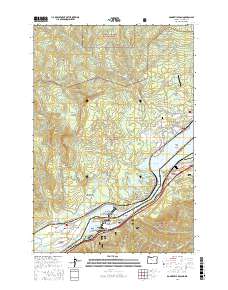
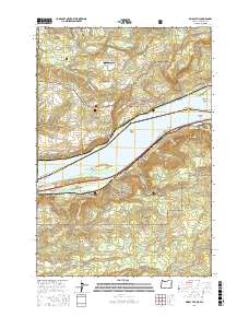
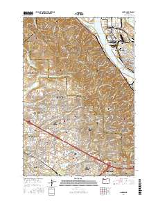
Historical Maps of Warrendale Through Time
56 maps found
1954 Linnton
Multnomah County, OR
1954 Mount Tabor
Multnomah County, OR
1954 Oswego
Multnomah County, OR
1954 Sauvie Island
Multnomah County, OR
1957 Bonneville Dam
Multnomah County, OR
1961 Linnton
Multnomah County, OR
1961 Mount Tabor
Multnomah County, OR
1961 Sauvie Island
Multnomah County, OR
1975 Linnton
Multnomah County, OR
1975 Mount Tabor
Multnomah County, OR

1976 Mount Tabor
Multnomah County, OR
1979 Tanner Butte
Multnomah County, OR
1986 Bridal Veil
Multnomah County, OR
1986 Multnomah Falls
Multnomah County, OR
1990 Linnton
Multnomah County, OR
1990 Mount Tabor
Multnomah County, OR
1990 Sauvie Island
Multnomah County, OR
1994 Bridal Veil
Multnomah County, OR
1994 Multnomah Falls
Multnomah County, OR
1994 Tanner Butte
Multnomah County, OR
2011 Bonneville Dam
Multnomah County, OR
2011 Bridal Veil
Multnomah County, OR
2011 Linnton
Multnomah County, OR

2011 Mount Tabor
Multnomah County, OR
2011 Multnomah Falls
Multnomah County, OR
2011 Sauvie Island
Multnomah County, OR
2011 Tanner Butte
Multnomah County, OR
2014 Bonneville Dam
Multnomah County, OR
2014 Bridal Veil
Multnomah County, OR
2014 Linnton
Multnomah County, OR
2014 Mount Tabor
Multnomah County, OR
2014 Multnomah Falls
Multnomah County, OR
2014 Sauvie Island
Multnomah County, OR
2014 Tanner Butte
Multnomah County, OR
2017 Bonneville Dam
Multnomah County, OR
2017 Bridal Veil
Multnomah County, OR
2017 Linnton
Multnomah County, OR
2017 Mount Tabor
Multnomah County, OR
2017 Multnomah Falls
Multnomah County, OR

2017 Sauvie Island
Multnomah County, OR

2017 Tanner Butte
Multnomah County, OR
2020 Bonneville Dam
Multnomah County, OR
2020 Bridal Veil
Multnomah County, OR
2020 Linnton
Multnomah County, OR
2020 Mount Tabor
Multnomah County, OR
2020 Multnomah Falls
Multnomah County, OR
2020 Sauvie Island
Multnomah County, OR
2020 Tanner Butte
Multnomah County, OR
2023 Bonneville Dam
Multnomah County, OR
2024 Bonneville Dam
Multnomah County, OR
2024 Bridal Veil
Multnomah County, OR
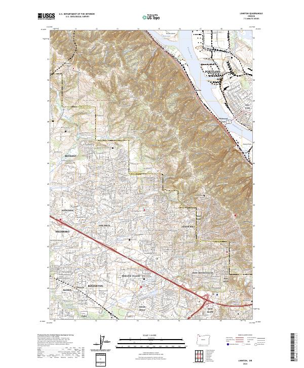
2024 Linnton
Multnomah County, OR
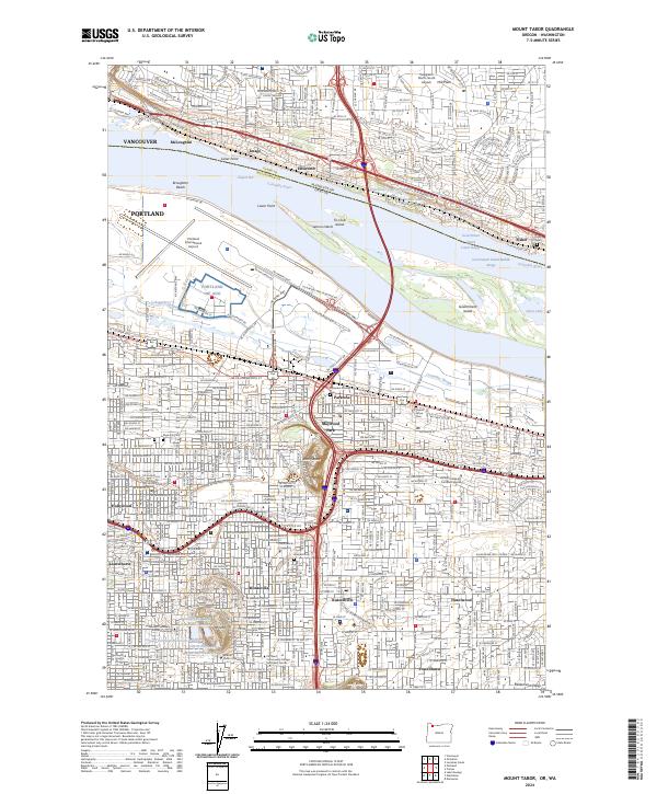
2024 Mount Tabor
Multnomah County, OR
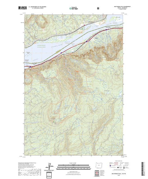
2024 Multnomah Falls
Multnomah County, OR
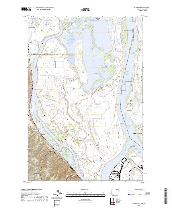
2024 Sauvie Island
Multnomah County, OR
2024 Tanner Butte
Multnomah County, OR