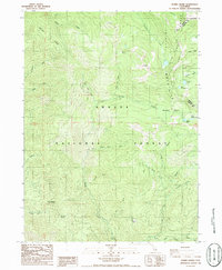
1986 Map of Mumbo Basin
USGS Topo · Published 1986About this map
The Trinity Mountains dominate this high-elevation landscape within the Shasta National Forest, where the border between Siskiyou and Trinity counties follows the ridgeline of the Eddys. This mid-1980s provisional survey shows a wilderness defined by its complex drainage systems and subalpine lakes, including Gumboot Lake, Picayune Lake, and the remote Mumbo Lake at the head of Mumbo Basin.
Find a feature on this map
41 named features on this map. Tap any name to fly to it.
Don’t see what you’re looking for? This feature index may not catch every label — zoom into the map to look around manually.
Map Details
Editions of this 1986 Mumbo Basin Map
2 editions found
Other maps of this area

1886 · Shasta
USGS Topo · 1:250,000

1894 · Shasta
USGS Topo · 1:250,000

1923 · Sawyers Bar
USGS Topo · 1:125,000

1931 · Etna
USGS Topo · 1:96,000

1934 · Etna
USGS Topo · 1:125,000

1935 · Dunsmuir
USGS Topo · 1:125,000

1948 · Weed
USGS Topo · 1:250,000

1950 · Weed
USGS Topo · 1:250,000

1954 · Weed
USGS Topo · 1:62,500

1954 · Dunsmuir
USGS Topo · 1:62,500