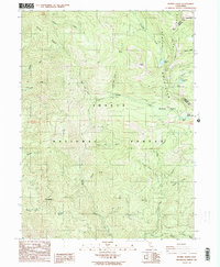
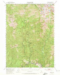
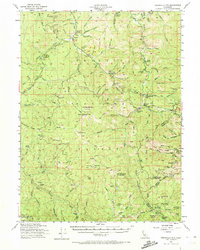
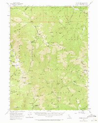
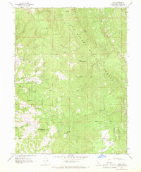
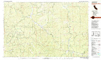
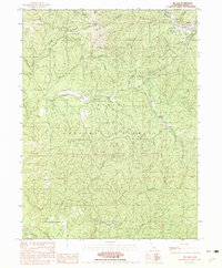
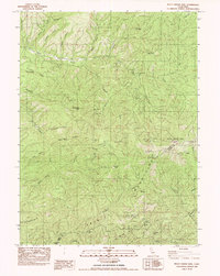
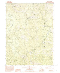
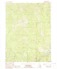
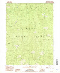
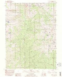
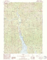
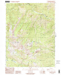
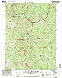
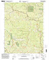
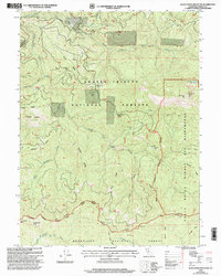
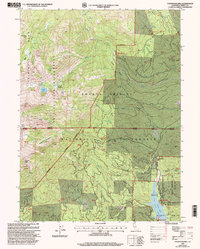
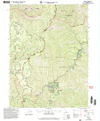
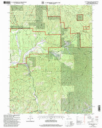
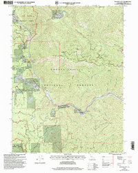
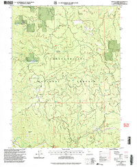
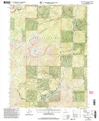
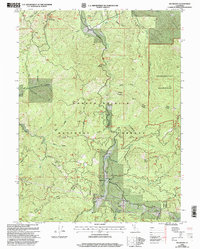
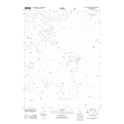
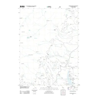
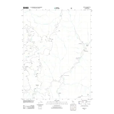
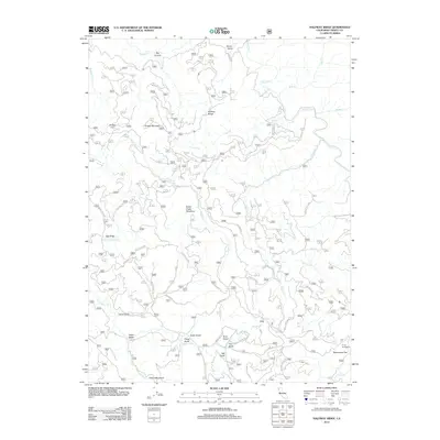
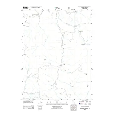
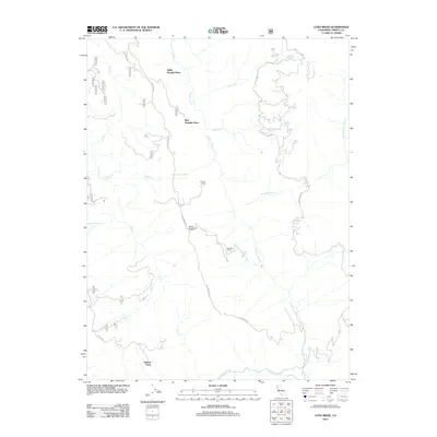
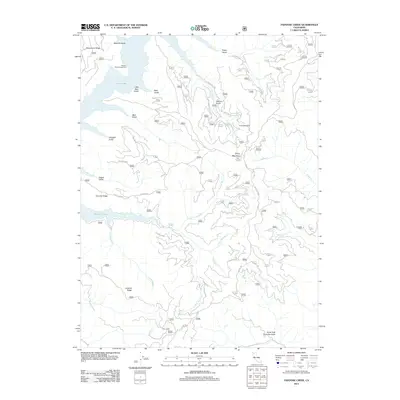
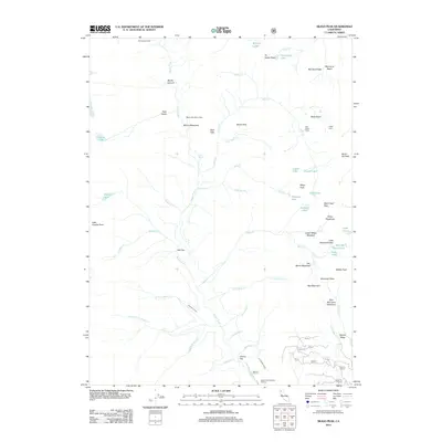
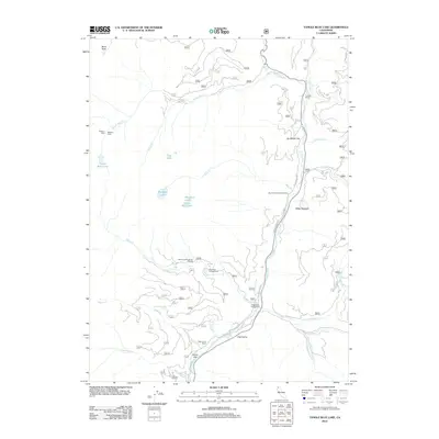
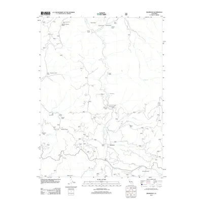
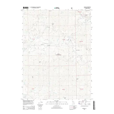
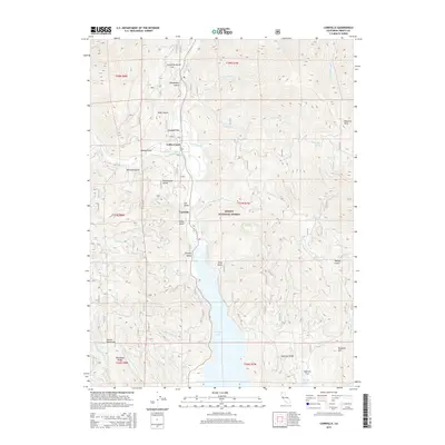
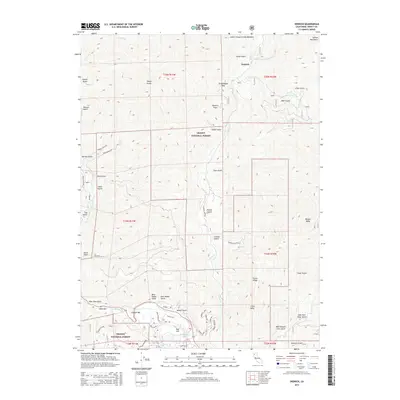
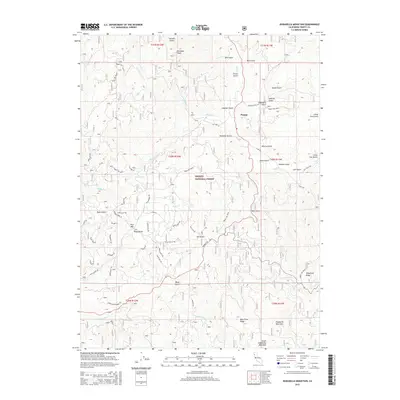
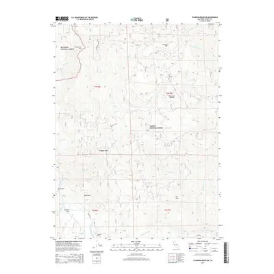
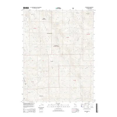
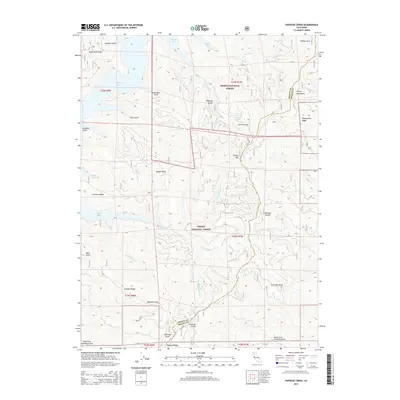
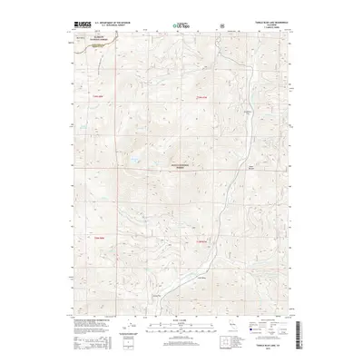
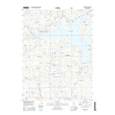
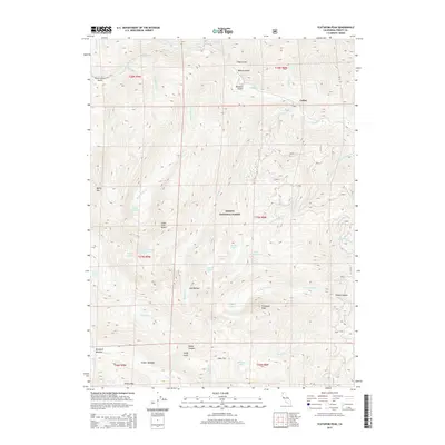
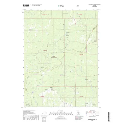
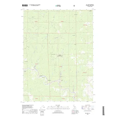
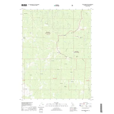
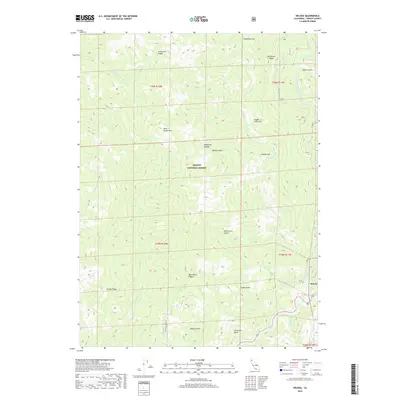
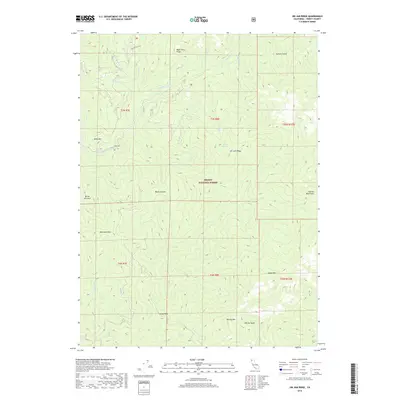
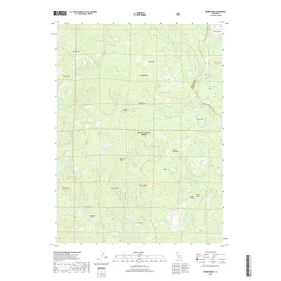
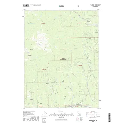
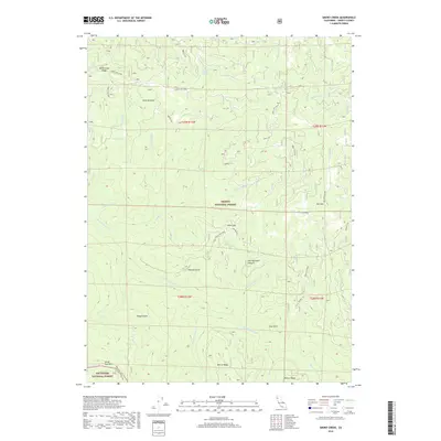
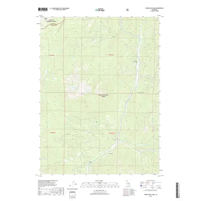
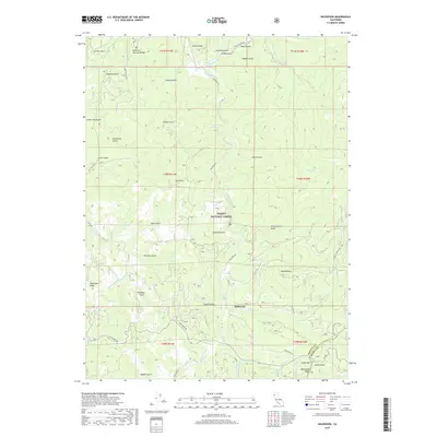
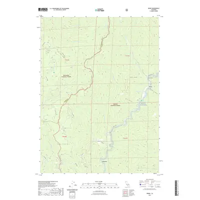
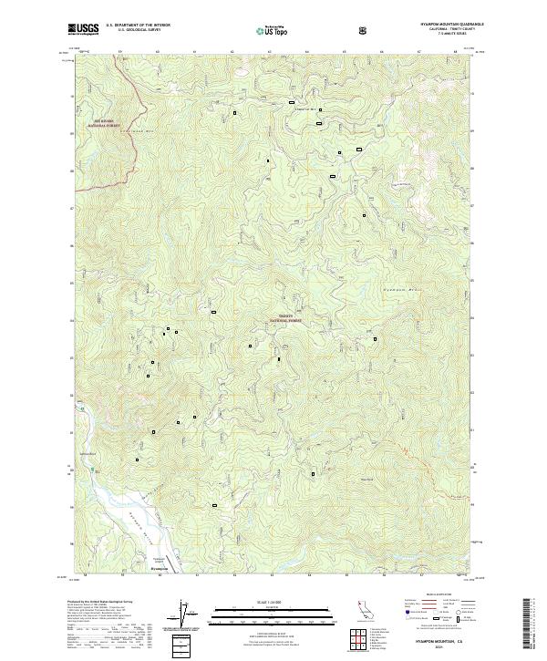
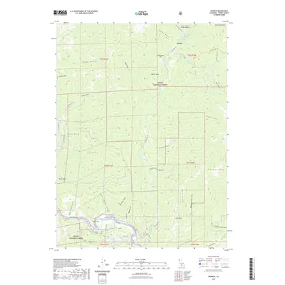
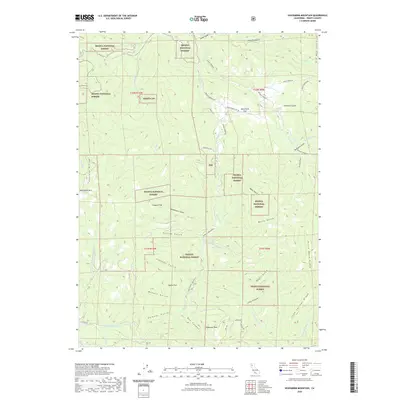
1986 Map of Mumbo Basin
USGS Topo · Published 1986About this map
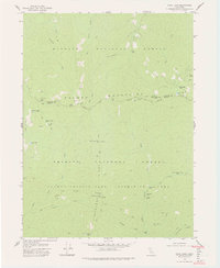
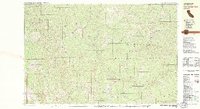
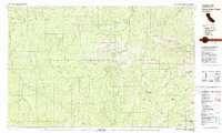
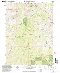
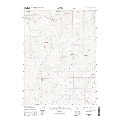
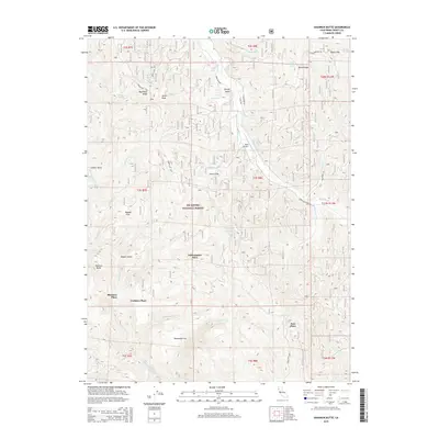
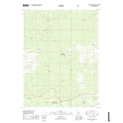
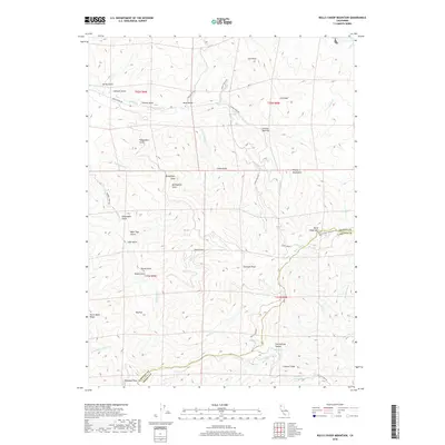
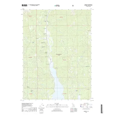
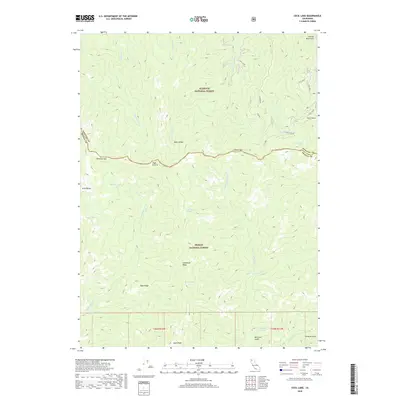
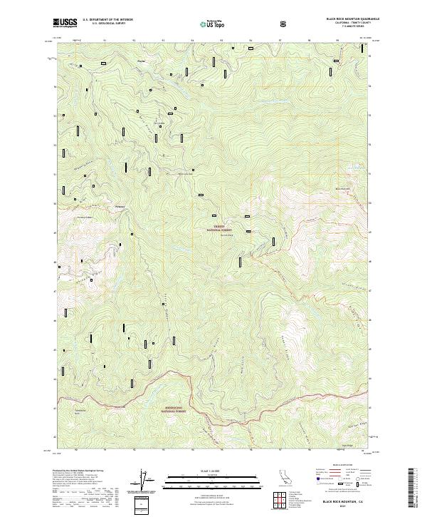
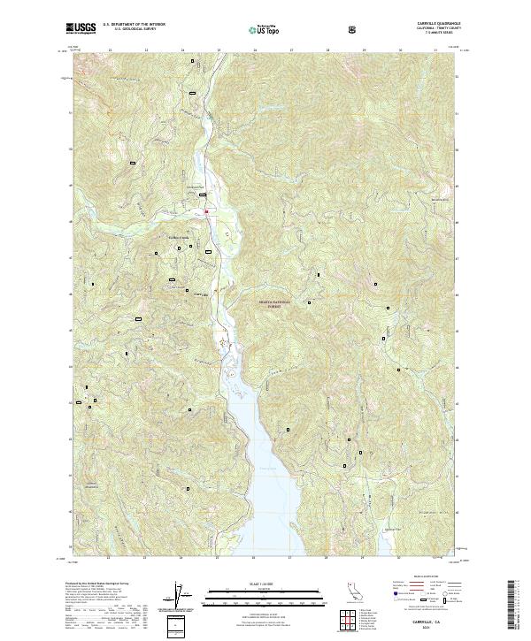
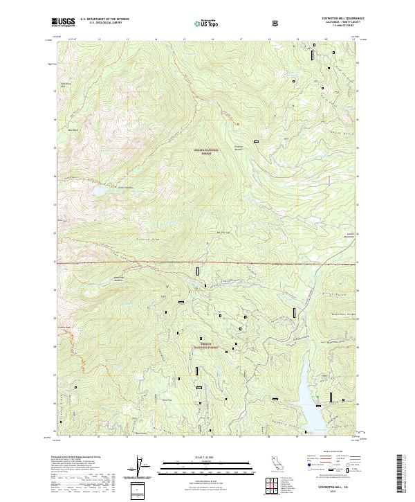
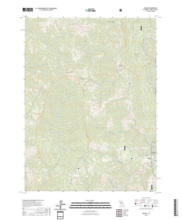
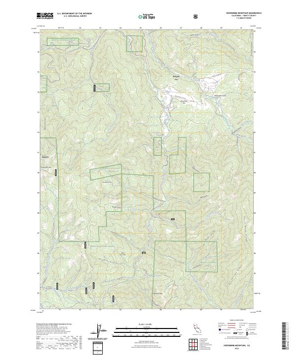
Trinity Mountains peaks and the high-elevation terrain of Shasta National Forest define this 1980s landscape along the border of Trinity and Siskiyou counties. The sheet captures a rugged wilderness characterized by deep canyons and glacial basins, notably the Mumbo Basin and the distinctively named The Bedstead. Resource extraction remains a visible part of the area's history, marked by the presence of the Altoona Mine and Integral Mine near the headwaters of the West Fork Trinity River. High alpine water bodies including Picayune Lake, Gumboot Lake, and Upper Mumbo Lake are scattered across the ridges, linked by primitive routes like the Picayune Trail. The map documents the complex drainage system where Ramshorn Creek and Mumbo Creek carve through the steep topography of Sherer Ridge and Blue Divide.
Find a feature on this map
37 named features on this map. Tap any name to fly to it.
Don’t see what you’re looking for? This feature index may not catch every label — zoom into the map to look around manually.
Map Details
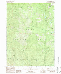
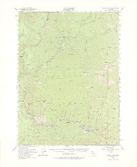
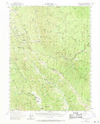
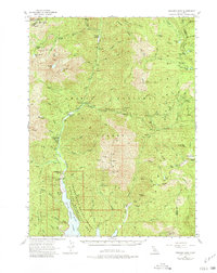
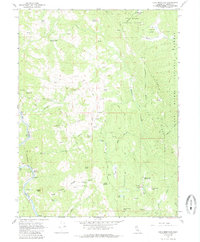
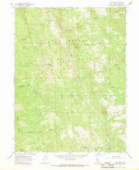
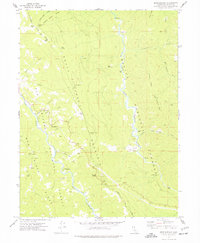
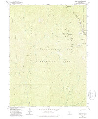
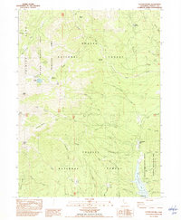
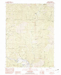
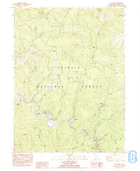
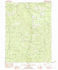
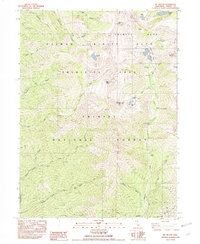
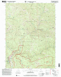
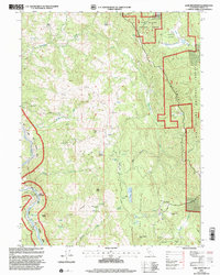
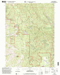
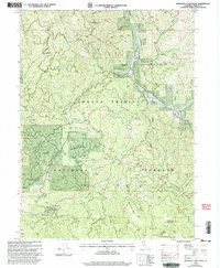
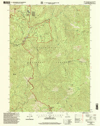
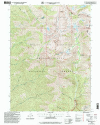
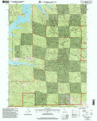
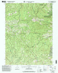
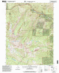
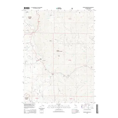
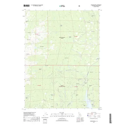
Editions of this 1986 Mumbo Basin Map
2 editions found
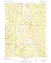
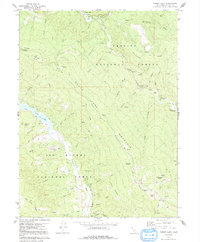
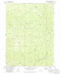
Historical Maps of Siskiyou County Through Time
293 maps found

1909 Big Bar
Trinity County, CA

1918 Anada
Trinity County, CA

1921 Hoaglin
Trinity County, CA

1922 Island Mountain
Trinity County, CA

1931 Hoaglin
Trinity County, CA
1935 Hoaglin
Trinity County, CA
1950 Trinity Dam
Trinity County, CA
1951 Helena
Trinity County, CA
1951 Ironside Mtn.
Trinity County, CA
1953 Blackrock Mtn
Trinity County, CA
1954 Blackrock Mtn
Trinity County, CA
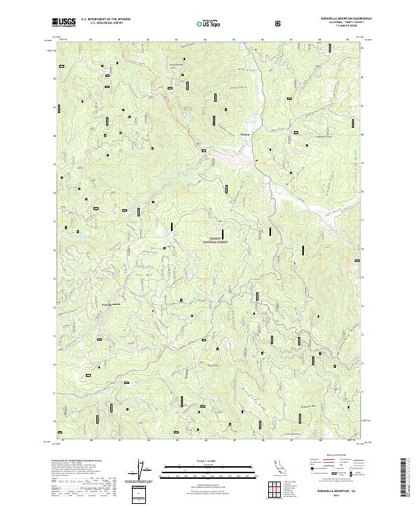
1954 Dubakella Mtn
Trinity County, CA
1954 Pickett Peak
Trinity County, CA
1955 Bonanza King
Trinity County, CA
1955 Kettenpom
Trinity County, CA
1955 Salmon Mtn
Trinity County, CA
1967 Lake Mountain
Trinity County, CA
1967 Long Ridge
Trinity County, CA
1967 Shannon Butte
Trinity County, CA
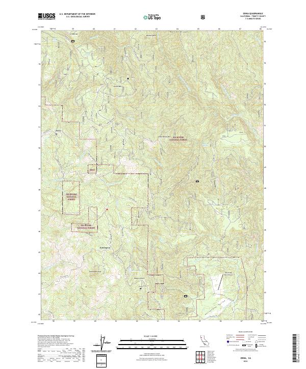
1967 Zenia
Trinity County, CA

1969 Bonanza King
Trinity County, CA
1973 Sportshaven
Trinity County, CA
1978 Dees Peak
Trinity County, CA
1978 Ruth Lake
Trinity County, CA
1979 Cecil Lake
Trinity County, CA
1979 Forest Glen
Trinity County, CA
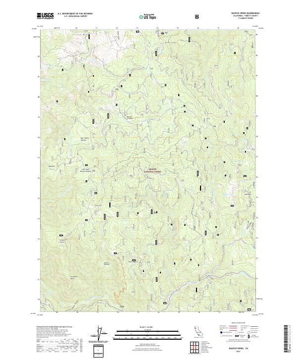
1979 Naufus Creek
Trinity County, CA
1981 Black Rock Mtn
Trinity County, CA
1981 Dubakella Mtn
Trinity County, CA
1981 Four Corners Rock
Trinity County, CA
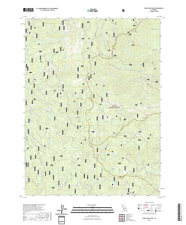
1981 Pony Buck Peak
Trinity County, CA
1982 Big Bar
Trinity County, CA
1982 Bully Choop Mtn
Trinity County, CA
1982 Covington Mill
Trinity County, CA
1982 Dedrick
Trinity County, CA
1982 Del Loma
Trinity County, CA
1982 Denny
Trinity County, CA
1982 Halfway Ridge
Trinity County, CA
1982 Hayfork Bally
Trinity County, CA
1982 Hayfork Summit
Trinity County, CA
1982 Helena
Trinity County, CA
1982 Hoosimbim Mtn.
Trinity County, CA
1982 Hyampom Mtn.
Trinity County, CA
1982 Ironside Mtn
Trinity County, CA
1982 Jim Jam Ridge
Trinity County, CA
1982 Mt. Hilton
Trinity County, CA
1982 Papoose Creek
Trinity County, CA
1982 Rush Creek Lakes
Trinity County, CA
1982 Siligo Peak
Trinity County, CA
1982 Thurston Peaks
Trinity County, CA
1982 Trinity Dam
Trinity County, CA
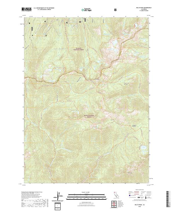
1986 Billys Peak
Trinity County, CA
1986 Carrville
Trinity County, CA
1986 Mumbo Basin
Trinity County, CA
1986 South China Mtn.
Trinity County, CA
1986 Tangle Blue Lake
Trinity County, CA
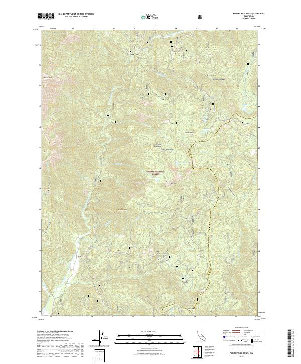
1986 Whisky Bill Peak
Trinity County, CA
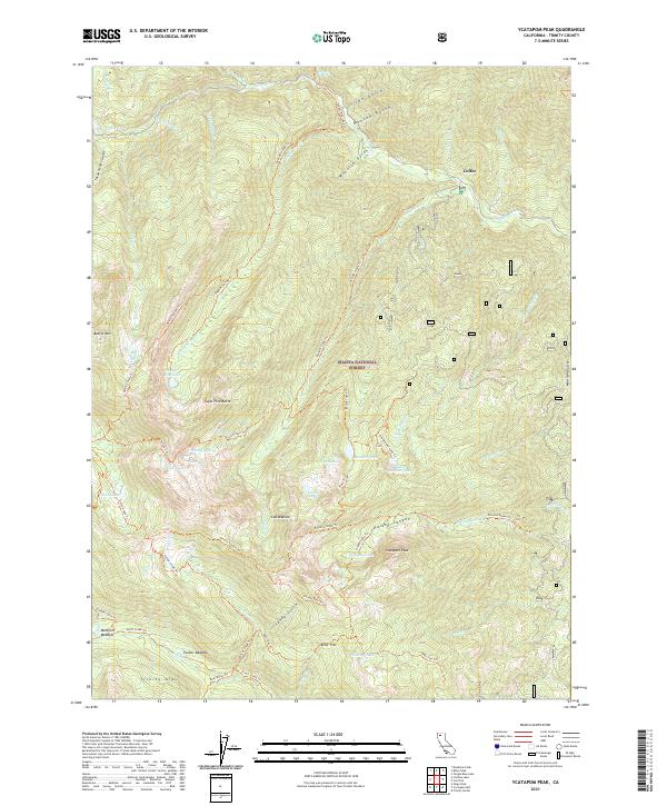
1986 Ycatapom Peak
Trinity County, CA
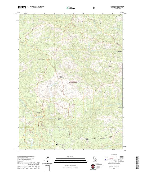
1995 Wrights Ridge
Trinity County, CA
1996 Lake Mountain
Trinity County, CA
1997 Forest Glen
Trinity County, CA
1997 Four Corners Rock
Trinity County, CA
1997 Lake Mountain
Trinity County, CA

1997 Long Ridge
Trinity County, CA
1997 Ruth Lake
Trinity County, CA
1997 Shannon Butte
Trinity County, CA
1997 Swim Ridge
Trinity County, CA
1997 Zenia
Trinity County, CA
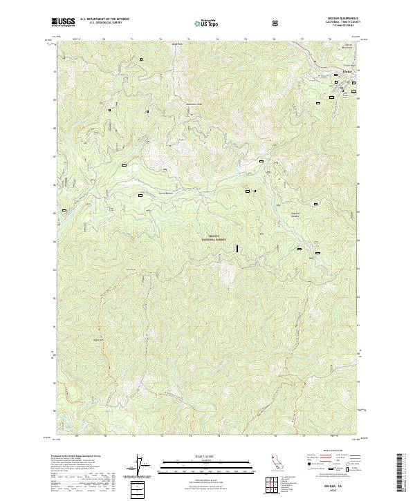
1998 Big Bar
Trinity County, CA
1998 Billys Peak
Trinity County, CA
1998 Black Rock Mountain
Trinity County, CA
1998 Carrville
Trinity County, CA
1998 Cecil Lake
Trinity County, CA
1998 Chanchelulla Peak
Trinity County, CA
1998 Covington Mill
Trinity County, CA
1998 Dedrick
Trinity County, CA
1998 Dees Peak
Trinity County, CA
1998 Del Loma
Trinity County, CA
1998 Denny
Trinity County, CA
1998 Dubakella Mountain
Trinity County, CA
1998 Halfway Ridge
Trinity County, CA
1998 Hayfork Bally
Trinity County, CA
1998 Hayfork Summit
Trinity County, CA
1998 Helena
Trinity County, CA
1998 Hoosimbim Mountain
Trinity County, CA
1998 Hyampom Mountain
Trinity County, CA
1998 Ironside Mtn
Trinity County, CA
1998 Jim Jam Ridge
Trinity County, CA
1998 Mount Hilton
Trinity County, CA
1998 Mumbo Basin
Trinity County, CA
1998 Naufus Creek
Trinity County, CA
1998 Papoose Creek
Trinity County, CA
1998 Pony Buck Peak
Trinity County, CA
1998 Rush Creek Lakes
Trinity County, CA
1998 Siligo Peak
Trinity County, CA
1998 Smoky Creek
Trinity County, CA
1998 South China Mountain
Trinity County, CA
1998 Sportshaven
Trinity County, CA
1998 Tangle Blue Lake
Trinity County, CA
1998 Thurston Peaks
Trinity County, CA
1998 Trinity Dam
Trinity County, CA
1998 Whisky Bill Peak
Trinity County, CA
1998 Wildwood
Trinity County, CA
1998 Ycatapom Peak
Trinity County, CA
2012 Big Bar
Trinity County, CA
2012 Billys Peak
Trinity County, CA
2012 Black Rock Mountain
Trinity County, CA

2012 Bully Choop Mountain
Trinity County, CA
2012 Carrville
Trinity County, CA
2012 Cecil Lake
Trinity County, CA
2012 Chanchelulla Peak
Trinity County, CA
2012 Covington Mill
Trinity County, CA
2012 Dedrick
Trinity County, CA
2012 Dees Peak
Trinity County, CA
2012 Del Loma
Trinity County, CA
2012 Denny
Trinity County, CA
2012 Dubakella Mountain
Trinity County, CA
2012 Forest Glen
Trinity County, CA
2012 Four Corners Rock
Trinity County, CA
2012 Halfway Ridge
Trinity County, CA
2012 Hayfork Bally
Trinity County, CA
2012 Hayfork Summit
Trinity County, CA
2012 Helena
Trinity County, CA
2012 Hoosimbim Mountain
Trinity County, CA

2012 Hyampom Mountain
Trinity County, CA
2012 Ironside Mountain
Trinity County, CA
2012 Jim Jam Ridge
Trinity County, CA
2012 Lake Mountain
Trinity County, CA
2012 Long Ridge
Trinity County, CA
2012 Mount Hilton
Trinity County, CA
2012 Mumbo Basin
Trinity County, CA
2012 Naufus Creek
Trinity County, CA
2012 Papoose Creek
Trinity County, CA
2012 Pony Buck Peak
Trinity County, CA
2012 Rush Creek Lakes
Trinity County, CA

2012 Ruth Lake
Trinity County, CA
2012 Shannon Butte
Trinity County, CA
2012 Siligo Peak
Trinity County, CA

2012 Smoky Creek
Trinity County, CA
2012 South China Mountain
Trinity County, CA
2012 Sportshaven
Trinity County, CA
2012 Swim Ridge
Trinity County, CA
2012 Tangle Blue Lake
Trinity County, CA
2012 Thurston Peaks
Trinity County, CA
2012 Trinity Dam
Trinity County, CA
2012 Whisky Bill Peak
Trinity County, CA
2012 Wildwood
Trinity County, CA
2012 Wrights Ridge
Trinity County, CA
2012 Ycatapom Peak
Trinity County, CA
2012 Zenia
Trinity County, CA
2015 Big Bar
Trinity County, CA
2015 Billys Peak
Trinity County, CA
2015 Black Rock Mountain
Trinity County, CA
2015 Bully Choop Mountain
Trinity County, CA
2015 Carrville
Trinity County, CA
2015 Cecil Lake
Trinity County, CA
2015 Chanchelulla Peak
Trinity County, CA
2015 Covington Mill
Trinity County, CA
2015 Dedrick
Trinity County, CA
2015 Dees Peak
Trinity County, CA
2015 Del Loma
Trinity County, CA
2015 Denny
Trinity County, CA
2015 Dubakella Mountain
Trinity County, CA
2015 Forest Glen
Trinity County, CA
2015 Four Corners Rock
Trinity County, CA
2015 Halfway Ridge
Trinity County, CA
2015 Hayfork Bally
Trinity County, CA
2015 Hayfork Summit
Trinity County, CA
2015 Helena
Trinity County, CA
2015 Hoosimbim Mountain
Trinity County, CA
2015 Hyampom Mountain
Trinity County, CA
2015 Ironside Mountain
Trinity County, CA
2015 Jim Jam Ridge
Trinity County, CA
2015 Lake Mountain
Trinity County, CA
2015 Long Ridge
Trinity County, CA
2015 Mount Hilton
Trinity County, CA
2015 Mumbo Basin
Trinity County, CA
2015 Naufus Creek
Trinity County, CA
2015 Papoose Creek
Trinity County, CA
2015 Pony Buck Peak
Trinity County, CA
2015 Rush Creek Lakes
Trinity County, CA
2015 Ruth Lake
Trinity County, CA
2015 Shannon Butte
Trinity County, CA
2015 Siligo Peak
Trinity County, CA
2015 Smoky Creek
Trinity County, CA
2015 South China Mountain
Trinity County, CA
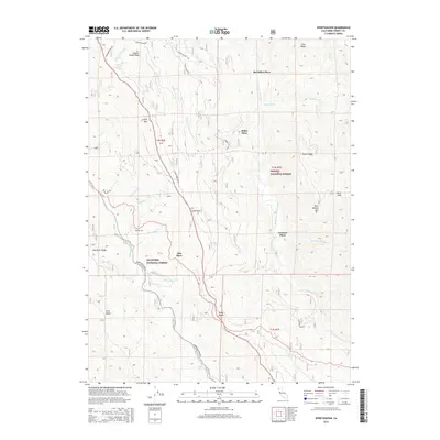
2015 Sportshaven
Trinity County, CA
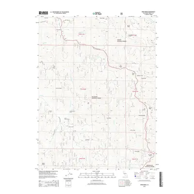
2015 Swim Ridge
Trinity County, CA
2015 Tangle Blue Lake
Trinity County, CA
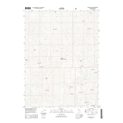
2015 Thurston Peaks
Trinity County, CA
2015 Trinity Dam
Trinity County, CA
2015 Whisky Bill Peak
Trinity County, CA
2015 Wildwood
Trinity County, CA
2015 Wrights Ridge
Trinity County, CA
2015 Ycatapom Peak
Trinity County, CA
2015 Zenia
Trinity County, CA
2018 Big Bar
Trinity County, CA
2018 Billys Peak
Trinity County, CA
2018 Black Rock Mountain
Trinity County, CA
2018 Bully Choop Mountain
Trinity County, CA
2018 Carrville
Trinity County, CA
2018 Cecil Lake
Trinity County, CA
2018 Chanchelulla Peak
Trinity County, CA
2018 Covington Mill
Trinity County, CA
2018 Dedrick
Trinity County, CA
2018 Dees Peak
Trinity County, CA
2018 Del Loma
Trinity County, CA
2018 Denny
Trinity County, CA
2018 Dubakella Mountain
Trinity County, CA
2018 Forest Glen
Trinity County, CA
2018 Four Corners Rock
Trinity County, CA
2018 Halfway Ridge
Trinity County, CA
2018 Hayfork Bally
Trinity County, CA
2018 Hayfork Summit
Trinity County, CA
2018 Helena
Trinity County, CA
2018 Hoosimbim Mountain
Trinity County, CA
2018 Hyampom Mountain
Trinity County, CA
2018 Ironside Mountain
Trinity County, CA
2018 Jim Jam Ridge
Trinity County, CA
2018 Lake Mountain
Trinity County, CA
2018 Long Ridge
Trinity County, CA
2018 Mount Hilton
Trinity County, CA
2018 Mumbo Basin
Trinity County, CA
2018 Naufus Creek
Trinity County, CA
2018 Papoose Creek
Trinity County, CA
2018 Pony Buck Peak
Trinity County, CA
2018 Rush Creek Lakes
Trinity County, CA
2018 Ruth Lake
Trinity County, CA
2018 Shannon Butte
Trinity County, CA
2018 Siligo Peak
Trinity County, CA
2018 Smoky Creek
Trinity County, CA
2018 South China Mountain
Trinity County, CA
2018 Sportshaven
Trinity County, CA
2018 Swim Ridge
Trinity County, CA
2018 Tangle Blue Lake
Trinity County, CA
2018 Thurston Peaks
Trinity County, CA
2018 Trinity Dam
Trinity County, CA
2018 Whisky Bill Peak
Trinity County, CA
2018 Wildwood
Trinity County, CA
2018 Wrights Ridge
Trinity County, CA
2018 Ycatapom Peak
Trinity County, CA
2018 Zenia
Trinity County, CA
2021 Black Rock Mountain
Trinity County, CA
2021 Carrville
Trinity County, CA
2021 Covington Mill
Trinity County, CA
2021 Denny
Trinity County, CA
2021 Dubakella Mountain
Trinity County, CA
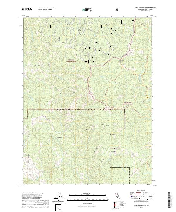
2021 Four Corners Rock
Trinity County, CA
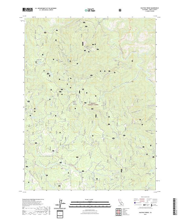
2021 Halfway Ridge
Trinity County, CA
2021 Hayfork Bally
Trinity County, CA
2021 Helena
Trinity County, CA
2021 Hyampom Mountain
Trinity County, CA
2021 Long Ridge
Trinity County, CA
2021 Mumbo Basin
Trinity County, CA
2021 Naufus Creek
Trinity County, CA
2021 Pony Buck Peak
Trinity County, CA

2021 Ruth Lake
Trinity County, CA
2021 Whisky Bill Peak
Trinity County, CA
2021 Wrights Ridge
Trinity County, CA
2021 Ycatapom Peak
Trinity County, CA
2021 Zenia
Trinity County, CA
2022 Big Bar
Trinity County, CA
2022 Billys Peak
Trinity County, CA
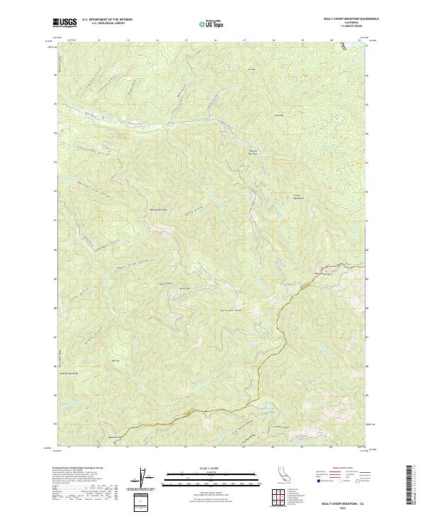
2022 Bully Choop Mountain
Trinity County, CA
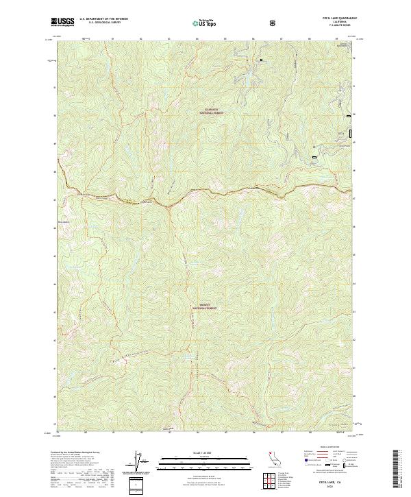
2022 Cecil Lake
Trinity County, CA
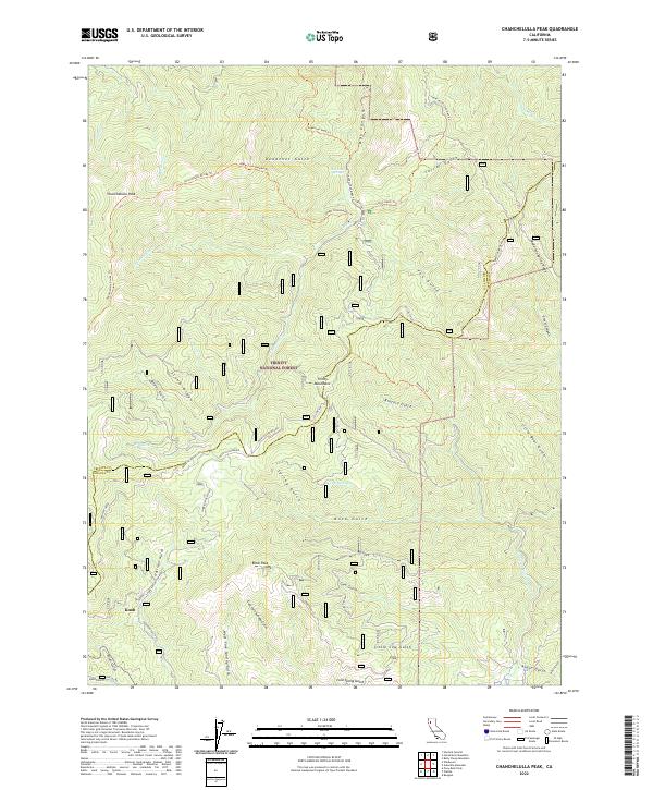
2022 Chanchelulla Peak
Trinity County, CA
2022 Dedrick
Trinity County, CA
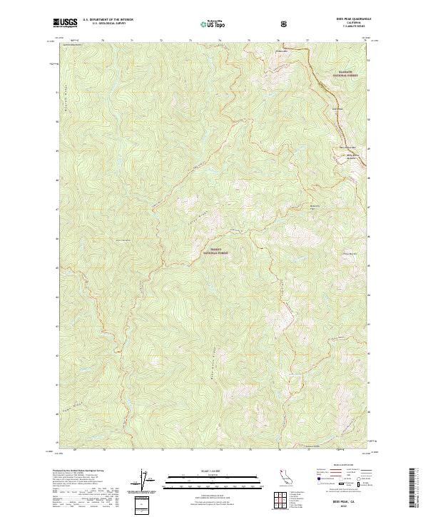
2022 Dees Peak
Trinity County, CA
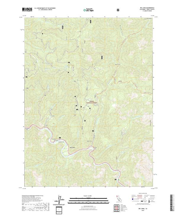
2022 Del Loma
Trinity County, CA
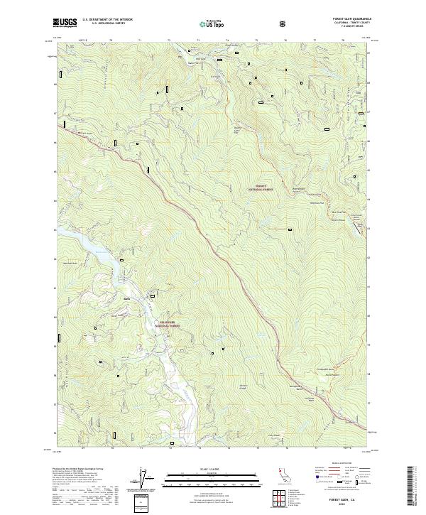
2022 Forest Glen
Trinity County, CA
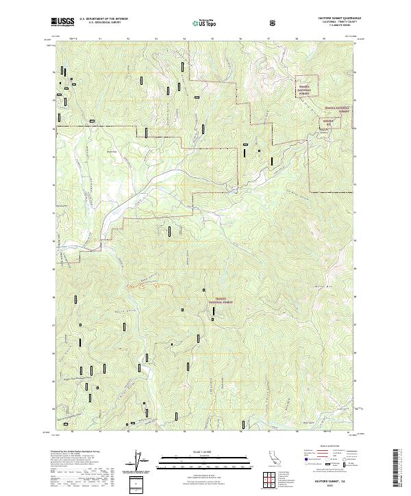
2022 Hayfork Summit
Trinity County, CA
2022 Hoosimbim Mountain
Trinity County, CA
2022 Ironside Mountain
Trinity County, CA
2022 Jim Jam Ridge
Trinity County, CA
2022 Lake Mountain
Trinity County, CA
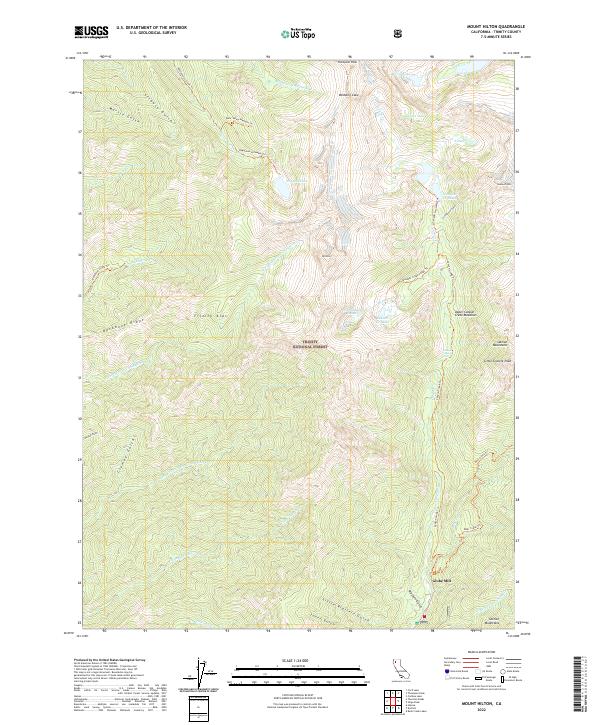
2022 Mount Hilton
Trinity County, CA
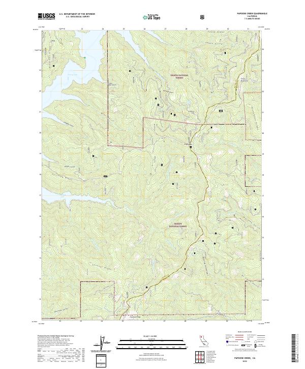
2022 Papoose Creek
Trinity County, CA
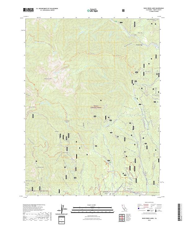
2022 Rush Creek Lakes
Trinity County, CA
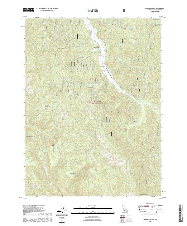
2022 Shannon Butte
Trinity County, CA
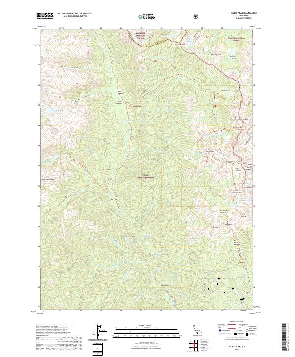
2022 Siligo Peak
Trinity County, CA
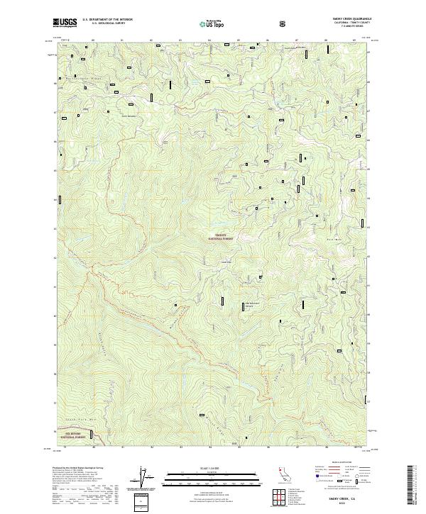
2022 Smoky Creek
Trinity County, CA
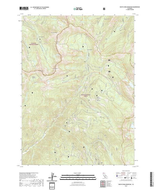
2022 South China Mountain
Trinity County, CA
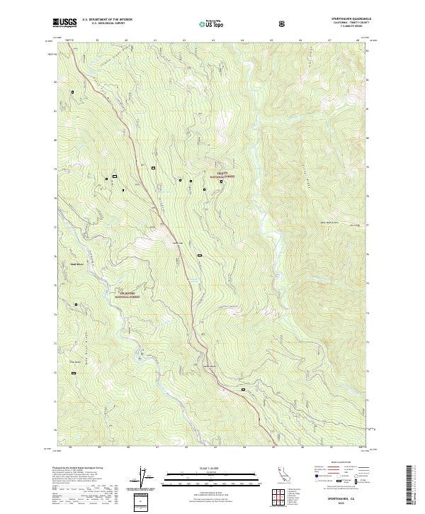
2022 Sportshaven
Trinity County, CA
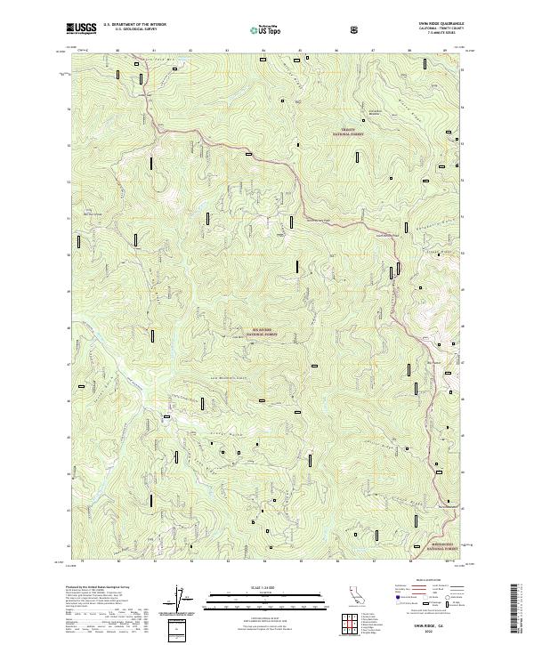
2022 Swim Ridge
Trinity County, CA
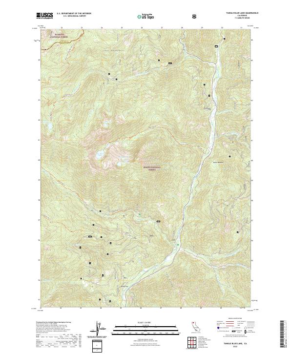
2022 Tangle Blue Lake
Trinity County, CA
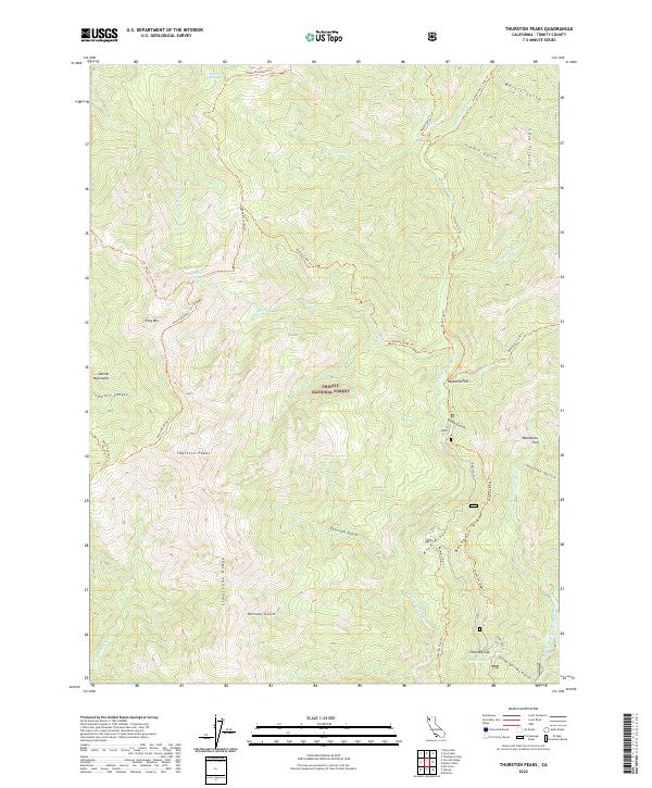
2022 Thurston Peaks
Trinity County, CA
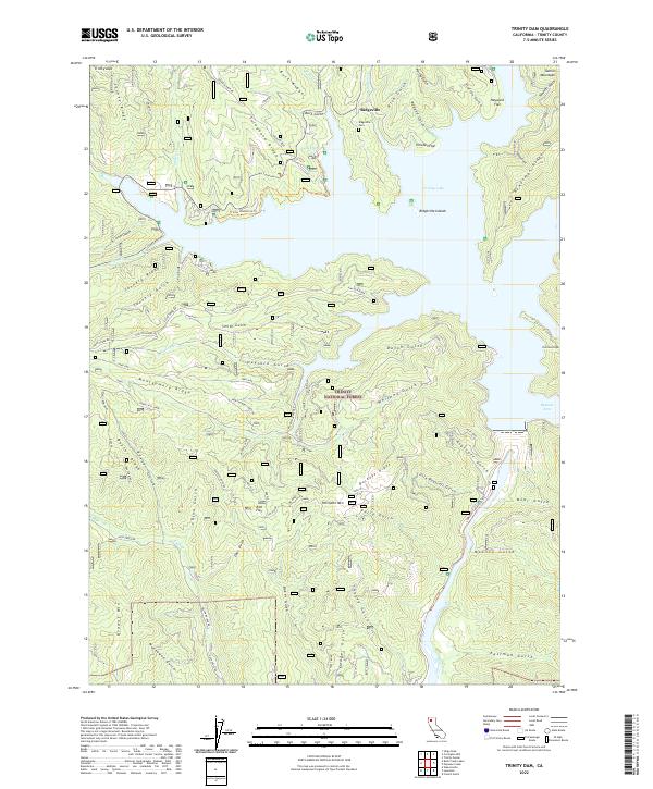
2022 Trinity Dam
Trinity County, CA
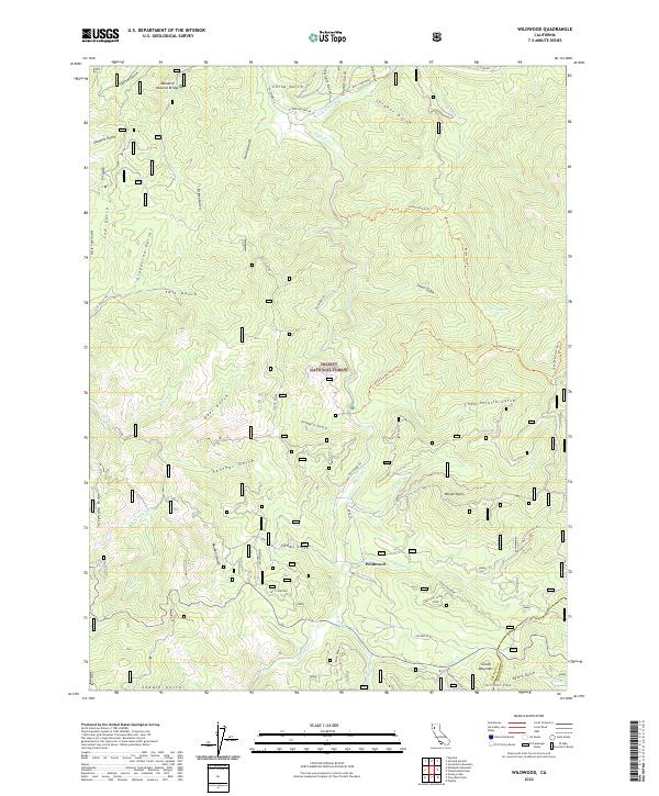
2022 Wildwood
Trinity County, CA
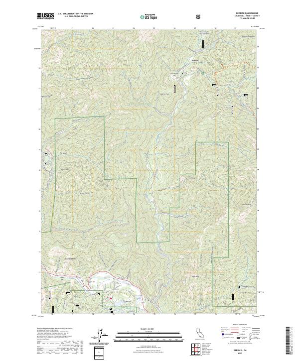
2023 Dedrick
Trinity County, CA
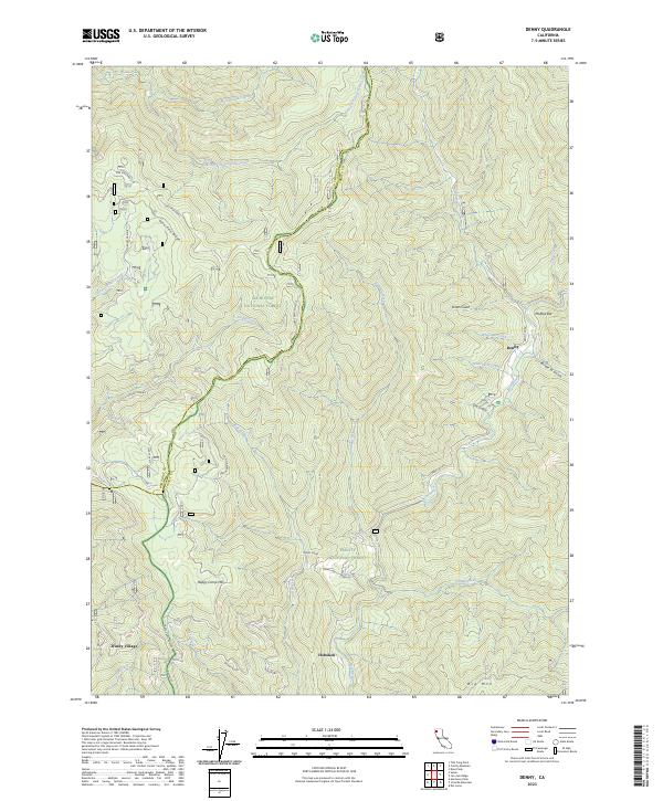
2023 Denny
Trinity County, CA
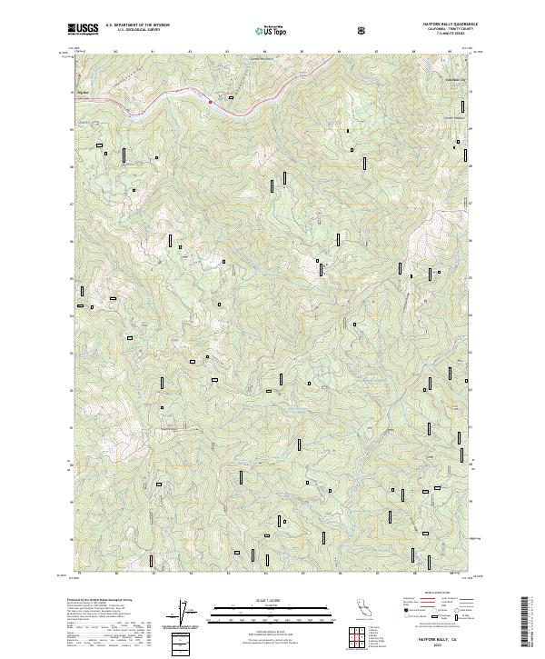
2023 Hayfork Bally
Trinity County, CA
2023 Helena
Trinity County, CA
2023 Hoosimbim Mountain
Trinity County, CA