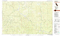
1981 Map of Dubakella Mtn
USGS Topo · Published 1981About this map
Wildwood and the surrounding reaches of the Trinity National Forest define this 1981 survey of northern California. The map records a landscape of resource management and rural infrastructure, from the Plummer Peak Lookout Tower to the industrial utility of the Blue Point Ditch and a pipeline cutting across Telephone Ridge. Local education and community nodes are anchored by the Wildwood Sch, while the presence of Trinity Pines and the small settlement of Peanut mark the thin population of the Trinity and Shasta County line.
Find a feature on this map
72 named features on this map. Tap any name to fly to it.
Don’t see what you’re looking for? This feature index may not catch every label — zoom into the map to look around manually.
Map Details
Editions of this 1981 Dubakella Mtn Map
2 editions found
Other maps of this area

1890 · Red Bluff
USGS Topo · 1:250,000

1894 · Red Bluff
USGS Topo · 1:250,000

1909 · Big Bar
USGS Topo · 1:96,000

1913 · Weaverville
USGS Topo · 1:125,000

1915 · Big Bar and Vicinity
USGS Topo · 1:250,000

1918 · Anada
USGS Topo · 1:62,500

1931 · Hoaglin
USGS Topo · 1:96,000

1935 · Hoaglin
USGS Topo · 1:125,000

1950 · Weaverville
USGS Topo · 1:62,500

1951 · Hayfork
USGS Topo · 1:62,500