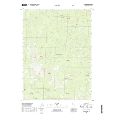
2018 Map of Ycatapom Peak
USGS Topo · Published 2018About this map
The settlement of Coffee sits along the upper reaches of Coffee Cr in this high-elevation region of the Shasta National Forest. The landscape is defined by the sharp verticality of the Trinity Alps, where prominent summits like Ycatapom Peak and Battle Mtn dominate the skyline. The area's complex drainage system is evident through the convergence of Boulder Cr, Swift Cr, and Sugar Pine Cr, which carve deep canyons between ridges such as Sugar Pine Butte.
Find a feature on this map
52 named features on this map. Tap any name to fly to it.
Don’t see what you’re looking for? This feature index may not catch every label — zoom into the map to look around manually.
Map Details
Editions of this 2018 Ycatapom Peak Map
This is the sole edition of this map. No revisions or reprints were ever made.
Other maps of this area

1886 · Shasta
USGS Topo · 1:250,000

1890 · Red Bluff
USGS Topo · 1:250,000

1894 · Red Bluff
USGS Topo · 1:250,000

1894 · Shasta
USGS Topo · 1:250,000

1913 · Weaverville
USGS Topo · 1:125,000

1923 · Sawyers Bar
USGS Topo · 1:125,000

1931 · Etna
USGS Topo · 1:96,000

1934 · Etna
USGS Topo · 1:125,000

1948 · Weed
USGS Topo · 1:250,000

1950 · Weed
USGS Topo · 1:250,000