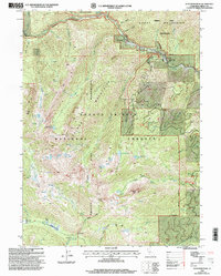
1998 Map of Ycatapom Peak
USGS Topo · Published 2003About this map
The Salmon Mountains and Scott Mountains converge in this high-elevation reach of Trinity County, defining a landscape where alpine lakes and narrow gulches dictate the movement of water and travelers. The presence of the Lady Slipper Mine near the northern boundary reflects the area's prospecting history, while the proximity of Coffee Creek Ranch and The Cedars along the upper reaches of Coffee Creek shows how early settlements clung to the canyon floors.
Find a feature on this map
53 named features on this map. Tap any name to fly to it.
Don’t see what you’re looking for? This feature index may not catch every label — zoom into the map to look around manually.
Map Details
Editions of this 1998 Ycatapom Peak Map
2 editions found
Other maps of this area

1886 · Shasta
USGS Topo · 1:250,000

1890 · Red Bluff
USGS Topo · 1:250,000

1894 · Red Bluff
USGS Topo · 1:250,000

1894 · Shasta
USGS Topo · 1:250,000

1913 · Weaverville
USGS Topo · 1:125,000

1923 · Sawyers Bar
USGS Topo · 1:125,000

1931 · Etna
USGS Topo · 1:96,000

1934 · Etna
USGS Topo · 1:125,000

1948 · Weed
USGS Topo · 1:250,000

1950 · Weed
USGS Topo · 1:250,000