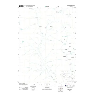
2012 Map of Siligo Peak
USGS Topo · Published 2012About this map
Siligo Peak serves as the focal point for this high-altitude landscape, where numerous glacial lakes and seasonal camps are connected by a network of drainage systems. Remote outposts such as Portuguese Camp and Longs Cabin are situated near the headwaters of major water bodies like Stuart Fork and Deer Cr. The map highlights a complex hydrographic system including Salmon Lake, Luella Lake, and Diamond Lake, many of which sit in high basins like Mumford Basin.
Find a feature on this map
64 named features on this map. Tap any name to fly to it.
Don’t see what you’re looking for? This feature index may not catch every label — zoom into the map to look around manually.
Map Details
Editions of this 2012 Siligo Peak Map
This is the sole edition of this map. No revisions or reprints were ever made.
Other maps of this area

1886 · Shasta
USGS Topo · 1:250,000

1890 · Red Bluff
USGS Topo · 1:250,000

1894 · Red Bluff
USGS Topo · 1:250,000

1894 · Shasta
USGS Topo · 1:250,000

1909 · Big Bar
USGS Topo · 1:96,000

1913 · Weaverville
USGS Topo · 1:125,000

1915 · Big Bar and Vicinity
USGS Topo · 1:250,000

1923 · Sawyers Bar
USGS Topo · 1:125,000

1931 · Etna
USGS Topo · 1:96,000

1934 · Etna
USGS Topo · 1:125,000