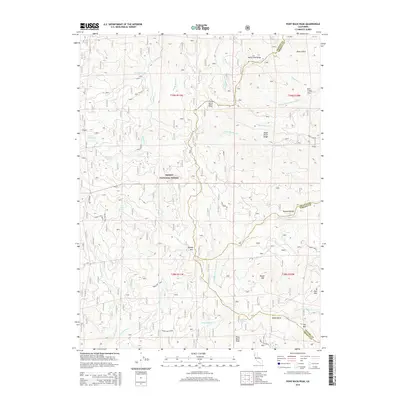
2015 Map of Pony Buck Peak
USGS Topo · Published 2015About this map
Pony Buck Peak stands as a prominent landmark in this corner of the Trinity National Forest, where the boundaries of Trinity, Shasta, and Tehama counties converge. The terrain is defined by a dense network of ridges and watercourses, including McFarland Ridge and Dead Horse Ridge that separate drainage basins for Hayfork Creek and the Middle Fork Cottonwood Creek. Isolated water sources such as Hackney Spring, Pine Root Spring, and Gum Spring are scattered across the slopes, while the evocatively named Hell to Find Lake sits in a high basin near the western edge. This survey documents the complex system of Forest Service access roads, including Forest Route 41 and Forest Route 29N10, which provide the primary infrastructure for this high-elevation backcountry. The map also captures geological markers like White Rock and Little Black Rock along with the summits of Brushy Mountain and Star Mountain.
Find a feature on this map
41 named features on this map. Tap any name to fly to it.
Don’t see what you’re looking for? This feature index may not catch every label — zoom into the map to look around manually.
Map Details
Editions of this 2015 Pony Buck Peak Map
This is the sole edition of this map. No revisions or reprints were ever made.
Other maps of this area

1890 · Red Bluff
USGS Topo · 1:250,000

1894 · Red Bluff
USGS Topo · 1:250,000

1931 · Hoaglin
USGS Topo · 1:96,000

1935 · Hoaglin
USGS Topo · 1:125,000

1951 · Chanchelulla Peak
USGS Topo · 1:62,500

1953 · Blackrock Mtn
USGS Topo · 1:62,500

1954 · Dubakella Mtn
USGS Topo · 1:62,500

1954 · Blackrock Mtn
USGS Topo · 1:62,500

1954 · Yolla Bolly
USGS Topo · 1:62,500

1958 · Redding
USGS Topo · 1:250,000