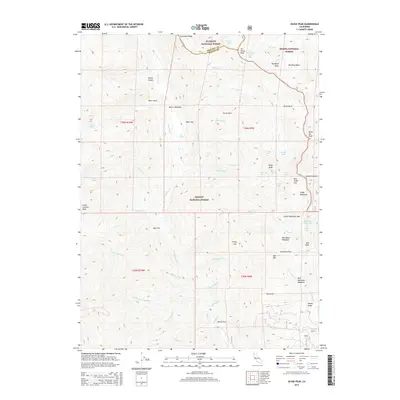
2015 Map of Siligo Peak
USGS Topo · Published 2015About this map
Morris Meadows and Oak Flat serve as key landmarks in this high-altitude wilderness where the borders of the Klamath, Shasta, and Trinity National Forests converge. The landscape is dominated by the jagged profiles of Sawtooth Ridge and Siligo Peak, part of the larger Trinity Alps system. A dense network of glacial basins and high-country water bodies, including Luella Lake, Diamond Lake, and Summit Lake, illustrate the complex hydrology of the region. Local travel is defined by narrow passages such as Stonewall Pass and Deer Creek Pass, while names like Van Matre Meadows and Cherry Flat reflect a long history of human presence in these remote reaches of Siskiyou and Trinity Counties.
Find a feature on this map
68 named features on this map. Tap any name to fly to it.
Don’t see what you’re looking for? This feature index may not catch every label — zoom into the map to look around manually.
Map Details
Editions of this 2015 Siligo Peak Map
This is the sole edition of this map. No revisions or reprints were ever made.
Other maps of this area

1886 · Shasta
USGS Topo · 1:250,000

1890 · Red Bluff
USGS Topo · 1:250,000

1894 · Red Bluff
USGS Topo · 1:250,000

1894 · Shasta
USGS Topo · 1:250,000

1909 · Big Bar
USGS Topo · 1:96,000

1913 · Weaverville
USGS Topo · 1:125,000

1915 · Big Bar and Vicinity
USGS Topo · 1:250,000

1923 · Sawyers Bar
USGS Topo · 1:125,000

1931 · Etna
USGS Topo · 1:96,000

1934 · Etna
USGS Topo · 1:125,000